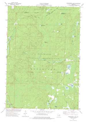
Fredenberg Lake Topo Map Wisconsin
To zoom in, hover over the map of Fredenberg Lake
USGS Topo Quad 45088a5 - 1:24,000 scale
| Topo Map Name: | Fredenberg Lake |
| USGS Topo Quad ID: | 45088a5 |
| Print Size: | ca. 21 1/4" wide x 27" high |
| Southeast Coordinates: | 45° N latitude / 88.5° W longitude |
| Map Center Coordinates: | 45.0625° N latitude / 88.5625° W longitude |
| U.S. State: | WI |
| Filename: | o45088a5.jpg |
| Download Map JPG Image: | Fredenberg Lake topo map 1:24,000 scale |
| Map Type: | Topographic |
| Topo Series: | 7.5´ |
| Map Scale: | 1:24,000 |
| Source of Map Images: | United States Geological Survey (USGS) |
| Alternate Map Versions: |
Fredenberg Lake WI 1973, updated 1977 Download PDF Buy paper map Fredenberg Lake WI 2011 Download PDF Buy paper map Fredenberg Lake WI 2013 Download PDF Buy paper map Fredenberg Lake WI 2015 Download PDF Buy paper map |
| FStopo: | US Forest Service topo Fredenberg Lake is available: Download FStopo PDF Download FStopo TIF |
1:24,000 Topo Quads surrounding Fredenberg Lake
> Back to 45088a1 at 1:100,000 scale
> Back to 45088a1 at 1:250,000 scale
> Back to U.S. Topo Maps home
Fredenberg Lake topo map: Gazetteer
Fredenberg Lake: Lakes
Beauprey Springs elevation 262m 859′Big Injun Lake elevation 274m 898′
Crystal Springs Lake elevation 286m 938′
Founder Lake elevation 272m 892′
Fredenberg Lake elevation 271m 889′
La Belle Lake elevation 265m 869′
Marsh Lake elevation 267m 875′
Pine Lake elevation 267m 875′
Saint Joseph Lake elevation 267m 875′
Sunia Lake elevation 303m 994′
Turtle Lake elevation 289m 948′
Vejo Lake elevation 271m 889′
Weso Lake elevation 268m 879′
Fredenberg Lake: Rapids
Chipmunk Rapids elevation 280m 918′Fredenberg Lake: Streams
First South Branch Oconto River elevation 286m 938′Founder Creek elevation 269m 882′
Fredenberg Lake digital topo map on disk
Buy this Fredenberg Lake topo map showing relief, roads, GPS coordinates and other geographical features, as a high-resolution digital map file on DVD:


