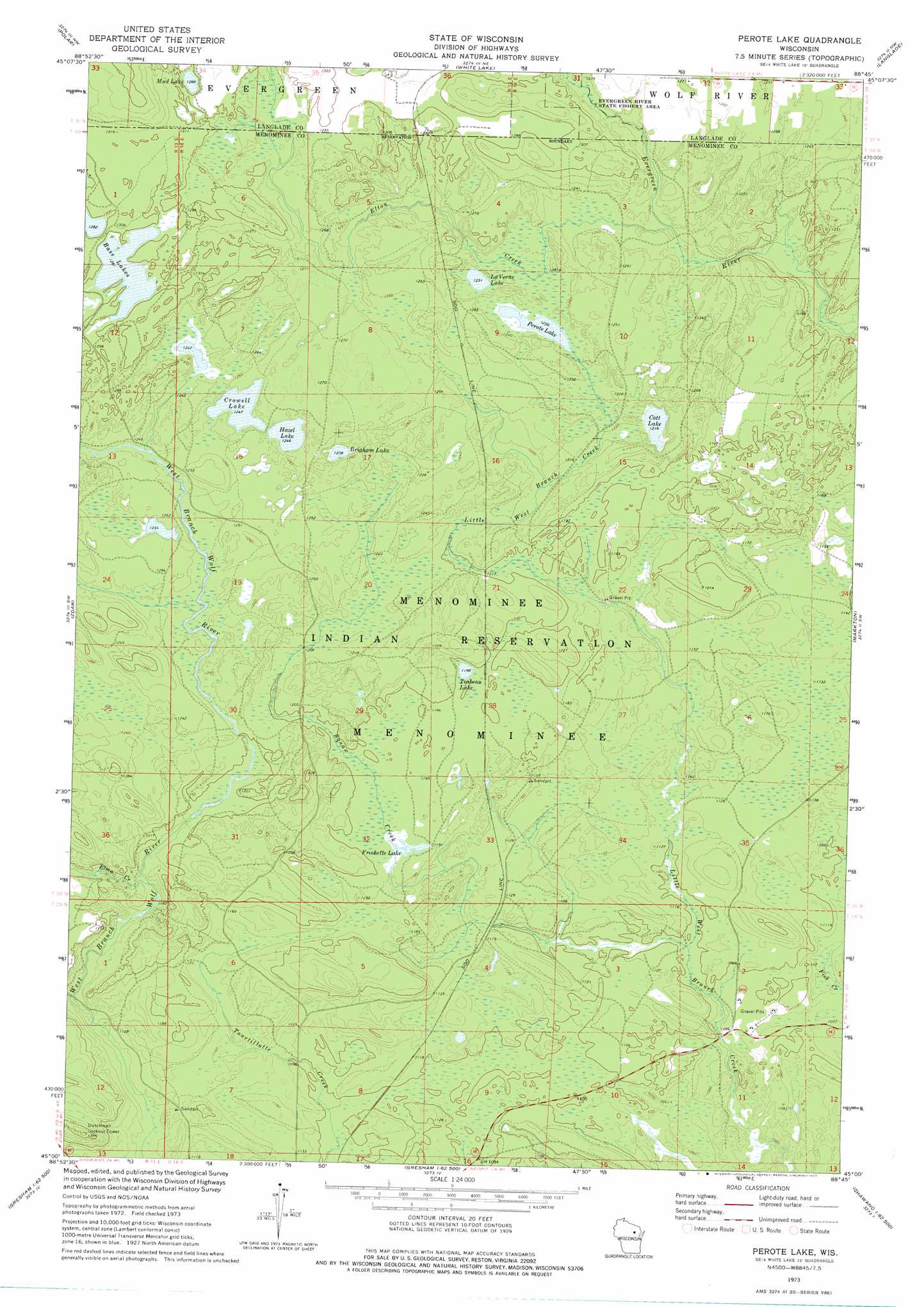
Perote Lake Topo Map Wisconsin
To zoom in, hover over the map of Perote Lake
USGS Topo Quad 45088a7 - 1:24,000 scale
| Topo Map Name: | Perote Lake |
| USGS Topo Quad ID: | 45088a7 |
| Print Size: | ca. 21 1/4" wide x 27" high |
| Southeast Coordinates: | 45° N latitude / 88.75° W longitude |
| Map Center Coordinates: | 45.0625° N latitude / 88.8125° W longitude |
| U.S. State: | WI |
| Filename: | o45088a7.jpg |
| Download Map JPG Image: | Perote Lake topo map 1:24,000 scale |
| Map Type: | Topographic |
| Topo Series: | 7.5´ |
| Map Scale: | 1:24,000 |
| Source of Map Images: | United States Geological Survey (USGS) |
| Alternate Map Versions: |
Perote Lake WI 1973, updated 1977 Download PDF Buy paper map Perote Lake WI 2010 Download PDF Buy paper map Perote Lake WI 2013 Download PDF Buy paper map Perote Lake WI 2015 Download PDF Buy paper map |
1:24,000 Topo Quads surrounding Perote Lake
Pearson |
Pickerel |
Lily |
Reservoir Pond |
Townsend |
Bryant |
Polar |
White Lake |
Langlade |
Shadow Lake |
Mattoon |
Zoar |
Perote Lake |
Markton |
Fredenberg Lake |
Regina |
Burney Lake |
Neopit |
Keshena |
Legend Lake |
Shepley |
Bowler |
Gresham |
Thornton |
Shawano |
> Back to 45088a1 at 1:100,000 scale
> Back to 45088a1 at 1:250,000 scale
> Back to U.S. Topo Maps home
Perote Lake topo map: Gazetteer
Perote Lake: Lakes
Brigham Lake elevation 375m 1230′Cott Lake elevation 371m 1217′
Crowell Lake elevation 380m 1246′
Frechette Lake elevation 362m 1187′
Hazel Lake elevation 380m 1246′
LaVerne Lake elevation 375m 1230′
Mud Lake elevation 396m 1299′
Perote Lake elevation 375m 1230′
Teabeau Lake elevation 365m 1197′
Perote Lake: Populated Places
Perote (historical) elevation 382m 1253′Perote Lake: Streams
Elma Creek elevation 348m 1141′Elton Creek elevation 370m 1213′
Squaw Creek elevation 330m 1082′
Perote Lake digital topo map on disk
Buy this Perote Lake topo map showing relief, roads, GPS coordinates and other geographical features, as a high-resolution digital map file on DVD: