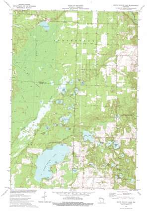
White Potato Lake Topo Map Wisconsin
To zoom in, hover over the map of White Potato Lake
USGS Topo Quad 45088b2 - 1:24,000 scale
| Topo Map Name: | White Potato Lake |
| USGS Topo Quad ID: | 45088b2 |
| Print Size: | ca. 21 1/4" wide x 27" high |
| Southeast Coordinates: | 45.125° N latitude / 88.125° W longitude |
| Map Center Coordinates: | 45.1875° N latitude / 88.1875° W longitude |
| U.S. State: | WI |
| Filename: | o45088b2.jpg |
| Download Map JPG Image: | White Potato Lake topo map 1:24,000 scale |
| Map Type: | Topographic |
| Topo Series: | 7.5´ |
| Map Scale: | 1:24,000 |
| Source of Map Images: | United States Geological Survey (USGS) |
| Alternate Map Versions: |
White Potato Lake WI 1973, updated 1977 Download PDF Buy paper map White Potato Lake WI 2010 Download PDF Buy paper map White Potato Lake WI 2013 Download PDF Buy paper map White Potato Lake WI 2015 Download PDF Buy paper map |
1:24,000 Topo Quads surrounding White Potato Lake
> Back to 45088a1 at 1:100,000 scale
> Back to 45088a1 at 1:250,000 scale
> Back to U.S. Topo Maps home
White Potato Lake topo map: Gazetteer
White Potato Lake: Airports
Patz Airport elevation 262m 859′White Potato Lake: Dams
Marsh Lake Dam elevation 233m 764′Nelligan Lake 2WP2564 Dam elevation 242m 793′
White Potato Lake: Lakes
Bahlert Lake elevation 240m 787′Bass Lake elevation 261m 856′
Bass Lake elevation 258m 846′
Bullhead Lake elevation 261m 856′
Frog Lake elevation 264m 866′
Gaffney Lake elevation 264m 866′
Giese Lake elevation 256m 839′
Gilas Lake elevation 256m 839′
Grass Lake elevation 265m 869′
Halfmoon Lake elevation 261m 856′
Heisel Lake elevation 250m 820′
Holt Lake elevation 262m 859′
House Lake elevation 236m 774′
Little Bass Lake elevation 262m 859′
Little Nelligan Lake elevation 239m 784′
Marsh Lake elevation 230m 754′
Mattrich Lake elevation 248m 813′
Mud Lake elevation 256m 839′
Mud Lake elevation 261m 856′
Murphy Lake elevation 224m 734′
Nelligan Lake elevation 240m 787′
Newbar Lake elevation 237m 777′
Perch Lake elevation 262m 859′
Perch Lake elevation 262m 859′
Pickerel Lake elevation 260m 853′
Rainbow Lake elevation 234m 767′
Ranch Lake elevation 266m 872′
Reader Lake elevation 262m 859′
White Potato Lake elevation 258m 846′
Yankee Lake elevation 263m 862′
White Potato Lake: Reservoirs
Marsh Lake 0.28 elevation 233m 764′Nelligan Lake elevation 242m 793′
White Potato Lake: Streams
North Branch Peshtigo Brook elevation 260m 853′West Branch Peshtigo Brook elevation 260m 853′
White Potato Lake digital topo map on disk
Buy this White Potato Lake topo map showing relief, roads, GPS coordinates and other geographical features, as a high-resolution digital map file on DVD:


