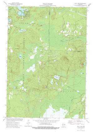
Shay Lake Topo Map Wisconsin
To zoom in, hover over the map of Shay Lake
USGS Topo Quad 45088b3 - 1:24,000 scale
| Topo Map Name: | Shay Lake |
| USGS Topo Quad ID: | 45088b3 |
| Print Size: | ca. 21 1/4" wide x 27" high |
| Southeast Coordinates: | 45.125° N latitude / 88.25° W longitude |
| Map Center Coordinates: | 45.1875° N latitude / 88.3125° W longitude |
| U.S. State: | WI |
| Filename: | o45088b3.jpg |
| Download Map JPG Image: | Shay Lake topo map 1:24,000 scale |
| Map Type: | Topographic |
| Topo Series: | 7.5´ |
| Map Scale: | 1:24,000 |
| Source of Map Images: | United States Geological Survey (USGS) |
| Alternate Map Versions: |
Shay Lake WI 1973, updated 1977 Download PDF Buy paper map Shay Lake WI 2011 Download PDF Buy paper map Shay Lake WI 2013 Download PDF Buy paper map Shay Lake WI 2015 Download PDF Buy paper map |
| FStopo: | US Forest Service topo Shay Lake is available: Download FStopo PDF Download FStopo TIF |
1:24,000 Topo Quads surrounding Shay Lake
> Back to 45088a1 at 1:100,000 scale
> Back to 45088a1 at 1:250,000 scale
> Back to U.S. Topo Maps home
Shay Lake topo map: Gazetteer
Shay Lake: Lakes
Bass Lake elevation 290m 951′Crooked Lake elevation 290m 951′
Farr Lake elevation 271m 889′
Gilkey Lake elevation 290m 951′
Grindle Lake elevation 288m 944′
Kobus Lake elevation 261m 856′
Lost Lake elevation 260m 853′
Nelligan Lake elevation 288m 944′
Shay Lake elevation 261m 856′
Turtle Lake elevation 269m 882′
Waupee Lake elevation 281m 921′
Shay Lake: Summits
Butler Rock elevation 333m 1092′Shay Lake digital topo map on disk
Buy this Shay Lake topo map showing relief, roads, GPS coordinates and other geographical features, as a high-resolution digital map file on DVD:


