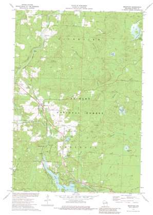
Mountain Topo Map Wisconsin
To zoom in, hover over the map of Mountain
USGS Topo Quad 45088b4 - 1:24,000 scale
| Topo Map Name: | Mountain |
| USGS Topo Quad ID: | 45088b4 |
| Print Size: | ca. 21 1/4" wide x 27" high |
| Southeast Coordinates: | 45.125° N latitude / 88.375° W longitude |
| Map Center Coordinates: | 45.1875° N latitude / 88.4375° W longitude |
| U.S. State: | WI |
| Filename: | o45088b4.jpg |
| Download Map JPG Image: | Mountain topo map 1:24,000 scale |
| Map Type: | Topographic |
| Topo Series: | 7.5´ |
| Map Scale: | 1:24,000 |
| Source of Map Images: | United States Geological Survey (USGS) |
| Alternate Map Versions: |
Mountain WI 1973 Download PDF Buy paper map Mountain WI 1973, updated 1977 Download PDF Buy paper map Mountain WI 1973, updated 1984 Download PDF Buy paper map Mountain WI 2011 Download PDF Buy paper map Mountain WI 2013 Download PDF Buy paper map Mountain WI 2015 Download PDF Buy paper map |
| FStopo: | US Forest Service topo Mountain is available: Download FStopo PDF Download FStopo TIF |
1:24,000 Topo Quads surrounding Mountain
> Back to 45088a1 at 1:100,000 scale
> Back to 45088a1 at 1:250,000 scale
> Back to U.S. Topo Maps home
Mountain topo map: Gazetteer
Mountain: Airports
Bowman Airport elevation 281m 921′Mountain: Channels
Waupee Flowage elevation 288m 944′Mountain: Dams
Chute 1865c371 Dam elevation 265m 869′Grindle Dam elevation 294m 964′
Mountain: Lakes
Bear Paw Lake elevation 282m 925′Green Lake elevation 277m 908′
Midget Lake elevation 273m 895′
Sunrise Lake elevation 292m 958′
Westphall Lake elevation 270m 885′
Mountain: Parks
Hagar Mountain State Natural Area elevation 292m 958′Mountain: Populated Places
Mountain elevation 296m 971′Mountain: Rapids
Bagley Rapids elevation 273m 895′Loon Rapids elevation 322m 1056′
Mountain: Reservoirs
Chute Pond elevation 265m 869′Chute Pond 188 elevation 265m 869′
Waupee Flowage 8 elevation 294m 964′
Mountain: Streams
Baldwin Creek elevation 278m 912′Hines Creek elevation 263m 862′
Little Waupee Creek elevation 265m 869′
Macauley Creek elevation 278m 912′
Town Creek elevation 278m 912′
Waupee Creek elevation 261m 856′
Mountain: Summits
Hagar Mountain elevation 356m 1167′Mountain digital topo map on disk
Buy this Mountain topo map showing relief, roads, GPS coordinates and other geographical features, as a high-resolution digital map file on DVD:


