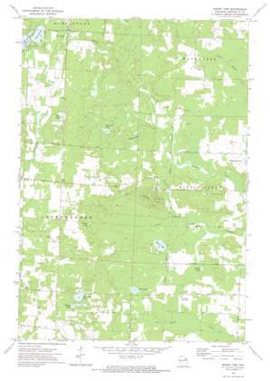
Mount Tom Topo Map Wisconsin
To zoom in, hover over the map of Mount Tom
USGS Topo Quad 45088c1 - 1:24,000 scale
| Topo Map Name: | Mount Tom |
| USGS Topo Quad ID: | 45088c1 |
| Print Size: | ca. 21 1/4" wide x 27" high |
| Southeast Coordinates: | 45.25° N latitude / 88° W longitude |
| Map Center Coordinates: | 45.3125° N latitude / 88.0625° W longitude |
| U.S. State: | WI |
| Filename: | o45088c1.jpg |
| Download Map JPG Image: | Mount Tom topo map 1:24,000 scale |
| Map Type: | Topographic |
| Topo Series: | 7.5´ |
| Map Scale: | 1:24,000 |
| Source of Map Images: | United States Geological Survey (USGS) |
| Alternate Map Versions: |
Mount Tom WI 1972, updated 1975 Download PDF Buy paper map Mount Tom WI 2010 Download PDF Buy paper map Mount Tom WI 2013 Download PDF Buy paper map Mount Tom WI 2015 Download PDF Buy paper map |
1:24,000 Topo Quads surrounding Mount Tom
> Back to 45088a1 at 1:100,000 scale
> Back to 45088a1 at 1:250,000 scale
> Back to U.S. Topo Maps home
Mount Tom topo map: Gazetteer
Mount Tom: Lakes
Campbell Lake elevation 238m 780′Charles Lake elevation 238m 780′
Chrizel Lake elevation 236m 774′
Engleman Lake elevation 237m 777′
Little Newton Lake elevation 273m 895′
Newton Lake elevation 273m 895′
Pine Lake elevation 273m 895′
Retcof Lake elevation 216m 708′
Round Lake elevation 219m 718′
Rush Lake elevation 220m 721′
Simpson Lake elevation 245m 803′
Star Lake elevation 274m 898′
Mount Tom: Streams
Plumadore Creek elevation 231m 757′Mount Tom: Summits
Mount Tom elevation 306m 1003′Mount Tom digital topo map on disk
Buy this Mount Tom topo map showing relief, roads, GPS coordinates and other geographical features, as a high-resolution digital map file on DVD:


