Lehman Lake Topo Map Wisconsin
To zoom in, hover over the map of Lehman Lake
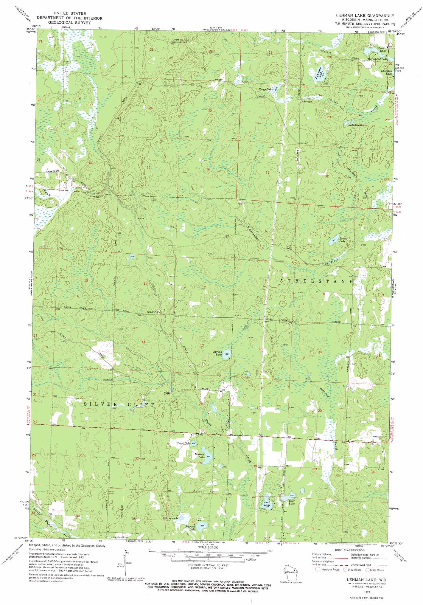
USGS Topo Quad 45088d2 - 1:24,000 scale
| Topo Map Name: | Lehman Lake |
| USGS Topo Quad ID: | 45088d2 |
| Print Size: | ca. 21 1/4" wide x 27" high |
| Southeast Coordinates: | 45.375° N latitude / 88.125° W longitude |
| Map Center Coordinates: | 45.4375° N latitude / 88.1875° W longitude |
| U.S. State: | WI |
| Filename: | o45088d2.jpg |
| Download Map JPG Image: | Lehman Lake topo map 1:24,000 scale |
| Map Type: | Topographic |
| Topo Series: | 7.5´ |
| Map Scale: | 1:24,000 |
| Source of Map Images: | United States Geological Survey (USGS) |
| Alternate Map Versions: |
Lehman Lake WI 1972, updated 1975 Download PDF Buy paper map Lehman Lake WI 2010 Download PDF Buy paper map Lehman Lake WI 2013 Download PDF Buy paper map Lehman Lake WI 2015 Download PDF Buy paper map |
1:24,000 Topo Quads surrounding Lehman Lake
Armstrong Creek |
Goodman |
Dunbar |
Dunbar Ne |
Pembine |
Goodman Sw |
Coleman Lake |
Twelvefoot Falls |
Town Corner Lake |
Amberg |
Mccaslin Mountain |
Roaring Rapids |
Lehman Lake |
Athelstane |
Wausaukee North |
Wheeler Lake |
Thunder Mountain |
High Falls Reservoir |
Mount Tom |
Wausaukee South |
Mountain |
Shay Lake |
White Potato Lake |
Crivitz |
Loomis |
> Back to 45088a1 at 1:100,000 scale
> Back to 45088a1 at 1:250,000 scale
> Back to U.S. Topo Maps home
Lehman Lake topo map: Gazetteer
Lehman Lake: Lakes
Deer Lake elevation 285m 935′Duck Lake elevation 303m 994′
Harwell Lake elevation 282m 925′
Heart Lake elevation 299m 980′
Horsehead Lake elevation 302m 990′
Lake Sixteen elevation 304m 997′
Lehman Lake elevation 312m 1023′
Little Spring Lake elevation 286m 938′
Lost Lake elevation 283m 928′
Murbou Lake elevation 293m 961′
Rosey Lake elevation 316m 1036′
Spring Lake elevation 306m 1003′
Trout Lake elevation 298m 977′
Lehman Lake digital topo map on disk
Buy this Lehman Lake topo map showing relief, roads, GPS coordinates and other geographical features, as a high-resolution digital map file on DVD: