Otter Lake Topo Map Wisconsin
To zoom in, hover over the map of Otter Lake
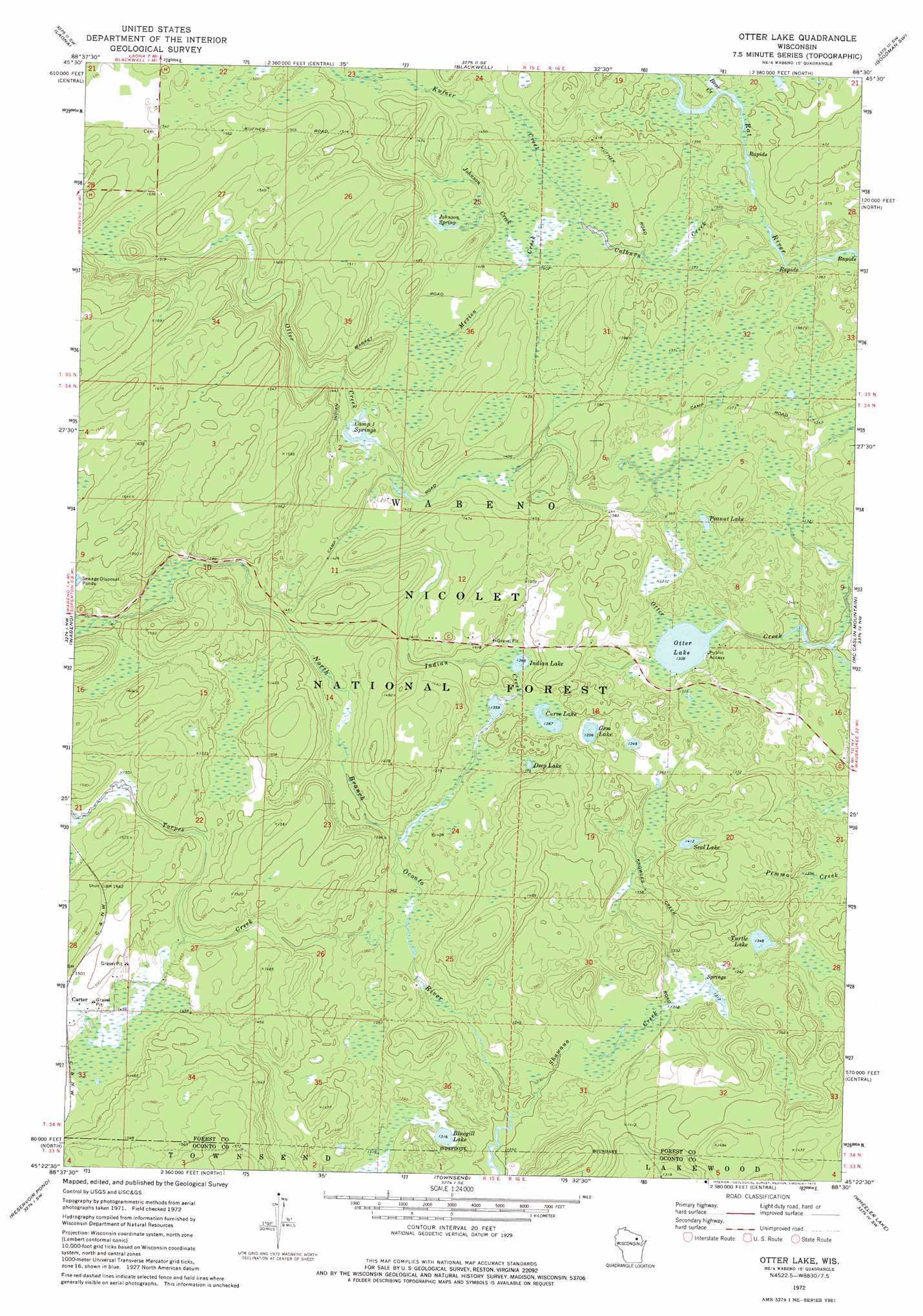
USGS Topo Quad 45088d5 - 1:24,000 scale
| Topo Map Name: | Otter Lake |
| USGS Topo Quad ID: | 45088d5 |
| Print Size: | ca. 21 1/4" wide x 27" high |
| Southeast Coordinates: | 45.375° N latitude / 88.5° W longitude |
| Map Center Coordinates: | 45.4375° N latitude / 88.5625° W longitude |
| U.S. State: | WI |
| Filename: | o45088d5.jpg |
| Download Map JPG Image: | Otter Lake topo map 1:24,000 scale |
| Map Type: | Topographic |
| Topo Series: | 7.5´ |
| Map Scale: | 1:24,000 |
| Source of Map Images: | United States Geological Survey (USGS) |
| Alternate Map Versions: |
Otter Lake WI 1972, updated 1975 Download PDF Buy paper map Otter Lake WI 2011 Download PDF Buy paper map Otter Lake WI 2013 Download PDF Buy paper map Otter Lake WI 2015 Download PDF Buy paper map |
| FStopo: | US Forest Service topo Otter Lake is available: Download FStopo PDF Download FStopo TIF |
1:24,000 Topo Quads surrounding Otter Lake
Crandon Ne |
Newald |
Lake Gordon |
Armstrong Creek |
Goodman |
Lake Lucerne |
Laona |
Blackwell |
Goodman Sw |
Coleman Lake |
Roberts Lake |
Wabeno |
Otter Lake |
Mccaslin Mountain |
Roaring Rapids |
Lily |
Reservoir Pond |
Townsend |
Wheeler Lake |
Thunder Mountain |
White Lake |
Langlade |
Shadow Lake |
Mountain |
Shay Lake |
> Back to 45088a1 at 1:100,000 scale
> Back to 45088a1 at 1:250,000 scale
> Back to U.S. Topo Maps home
Otter Lake topo map: Gazetteer
Otter Lake: Lakes
Bluegill Lake elevation 402m 1318′Camp One Springs elevation 434m 1423′
Curve Lake elevation 417m 1368′
Deep Lake elevation 421m 1381′
Gem Lake elevation 413m 1354′
Indian Lake elevation 418m 1371′
Otter Lake elevation 399m 1309′
Peanut Lake elevation 408m 1338′
Seal Lake elevation 430m 1410′
Turtle Lake elevation 411m 1348′
Otter Lake: Springs
Johnson Spring elevation 437m 1433′Otter Lake: Streams
Bear Creek elevation 421m 1381′Colburn Creek elevation 413m 1354′
Indian Creek elevation 413m 1354′
Johnson Creek elevation 430m 1410′
Kufner Creek elevation 427m 1400′
Mexico Creek elevation 427m 1400′
Shawano Creek elevation 396m 1299′
Torpee Creek elevation 412m 1351′
Otter Lake digital topo map on disk
Buy this Otter Lake topo map showing relief, roads, GPS coordinates and other geographical features, as a high-resolution digital map file on DVD: