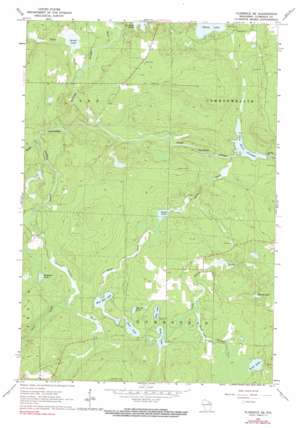
Florence Se Topo Map Wisconsin
To zoom in, hover over the map of Florence Se
USGS Topo Quad 45088g3 - 1:24,000 scale
| Topo Map Name: | Florence Se |
| USGS Topo Quad ID: | 45088g3 |
| Print Size: | ca. 21 1/4" wide x 27" high |
| Southeast Coordinates: | 45.75° N latitude / 88.25° W longitude |
| Map Center Coordinates: | 45.8125° N latitude / 88.3125° W longitude |
| U.S. State: | WI |
| Filename: | o45088g3.jpg |
| Download Map JPG Image: | Florence Se topo map 1:24,000 scale |
| Map Type: | Topographic |
| Topo Series: | 7.5´ |
| Map Scale: | 1:24,000 |
| Source of Map Images: | United States Geological Survey (USGS) |
| Alternate Map Versions: |
Florence SE WI 1962, updated 1964 Download PDF Buy paper map Florence SE WI 1962, updated 1991 Download PDF Buy paper map Florence SE WI 2010 Download PDF Buy paper map Florence SE WI 2013 Download PDF Buy paper map Florence SE WI 2015 Download PDF Buy paper map |
1:24,000 Topo Quads surrounding Florence Se
> Back to 45088e1 at 1:100,000 scale
> Back to 45088a1 at 1:250,000 scale
> Back to U.S. Topo Maps home
Florence Se topo map: Gazetteer
Florence Se: Dams
Halls Creek Wildlife Flowage 3WR1799 Dam elevation 390m 1279′Pine River Dam elevation 357m 1171′
Pine River WP146 Dam elevation 363m 1190′
Florence Se: Lakes
Bass Lake elevation 397m 1302′Buckskin Lake elevation 409m 1341′
Bush Lake elevation 396m 1299′
Emily Lake elevation 381m 1250′
Halls Lake elevation 393m 1289′
Jutra Lake elevation 381m 1250′
Marm Lake elevation 387m 1269′
Mirror Lake elevation 401m 1315′
Sand Lake elevation 399m 1309′
Scout Lake elevation 396m 1299′
Seidel Lake elevation 381m 1250′
West Bass Lake elevation 395m 1295′
Florence Se: Parks
Homestead Park elevation 402m 1318′Florence Se: Rapids
Pine Rapids elevation 372m 1220′Popple Rapids elevation 380m 1246′
Florence Se: Reservoirs
Halls Lake 4.95 elevation 390m 1279′Pine River Flowage elevation 357m 1171′
Pine River Flowage 543 elevation 363m 1190′
Florence Se: Streams
Halls Creek elevation 364m 1194′Lamon Tangue Creek elevation 395m 1295′
Lund Creek elevation 402m 1318′
Meyers Creek elevation 381m 1250′
Popple River elevation 378m 1240′
Sand Lake Branch elevation 393m 1289′
Seidel Creek elevation 378m 1240′
Woods Creek elevation 382m 1253′
Florence Se digital topo map on disk
Buy this Florence Se topo map showing relief, roads, GPS coordinates and other geographical features, as a high-resolution digital map file on DVD:


