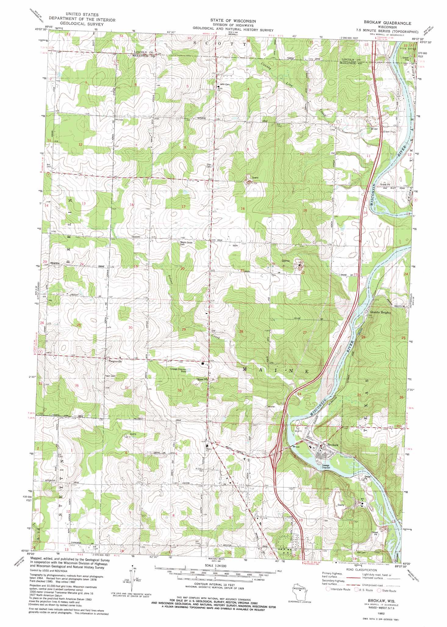
Brokaw Topo Map Wisconsin
To zoom in, hover over the map of Brokaw
USGS Topo Quad 45089a6 - 1:24,000 scale
| Topo Map Name: | Brokaw |
| USGS Topo Quad ID: | 45089a6 |
| Print Size: | ca. 21 1/4" wide x 27" high |
| Southeast Coordinates: | 45° N latitude / 89.625° W longitude |
| Map Center Coordinates: | 45.0625° N latitude / 89.6875° W longitude |
| U.S. State: | WI |
| Filename: | o45089a6.jpg |
| Download Map JPG Image: | Brokaw topo map 1:24,000 scale |
| Map Type: | Topographic |
| Topo Series: | 7.5´ |
| Map Scale: | 1:24,000 |
| Source of Map Images: | United States Geological Survey (USGS) |
| Alternate Map Versions: |
Brokaw WI 1982, updated 1983 Download PDF Buy paper map Brokaw WI 2010 Download PDF Buy paper map Brokaw WI 2013 Download PDF Buy paper map Brokaw WI 2015 Download PDF Buy paper map |
1:24,000 Topo Quads surrounding Brokaw
Natzke Camp |
Grandfather Falls |
Irma |
Bloomville |
Gleason |
Fromm Lookout Tower |
Alexander Lake |
Merrill |
Pine Dells |
Doering |
Hamburg |
Little Chicago |
Brokaw |
Nutterville |
Kalinke |
Edgar |
Marathon |
Wausau West |
Wausau East |
Ringle |
Marathon Sw |
Halder |
Mosinee |
Peplin |
Bevent |
> Back to 45089a1 at 1:100,000 scale
> Back to 45088a1 at 1:250,000 scale
> Back to U.S. Topo Maps home
Brokaw topo map: Gazetteer
Brokaw: Populated Places
Brokaw elevation 372m 1220′Granite Heights elevation 369m 1210′
Taegesville elevation 427m 1400′
Brokaw: Post Offices
Brokaw Post Office elevation 371m 1217′Brokaw: Streams
County Line Creek elevation 373m 1223′Lentz Creek elevation 365m 1197′
Brokaw digital topo map on disk
Buy this Brokaw topo map showing relief, roads, GPS coordinates and other geographical features, as a high-resolution digital map file on DVD: