Little Chicago Topo Map Wisconsin
To zoom in, hover over the map of Little Chicago
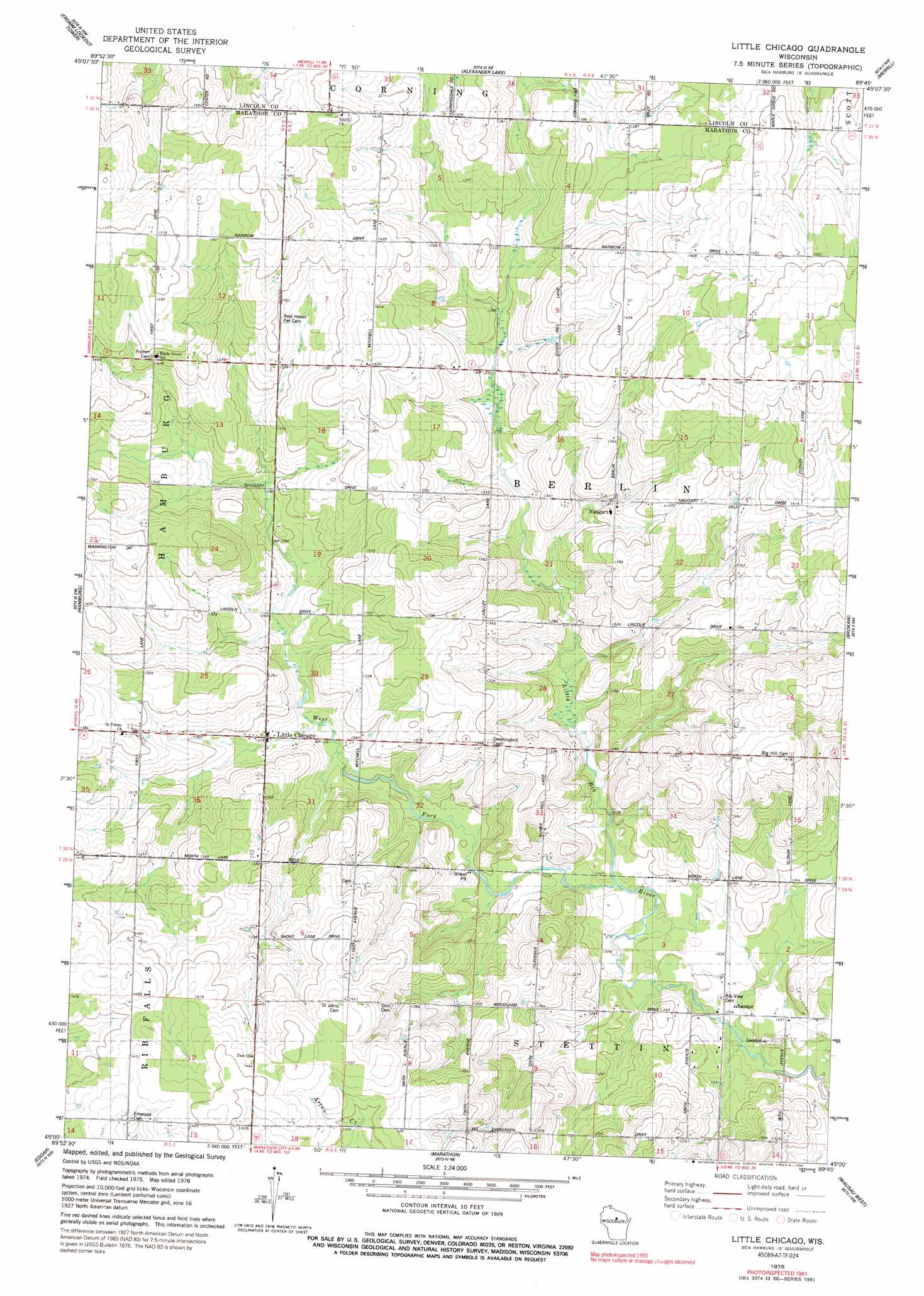
USGS Topo Quad 45089a7 - 1:24,000 scale
| Topo Map Name: | Little Chicago |
| USGS Topo Quad ID: | 45089a7 |
| Print Size: | ca. 21 1/4" wide x 27" high |
| Southeast Coordinates: | 45° N latitude / 89.75° W longitude |
| Map Center Coordinates: | 45.0625° N latitude / 89.8125° W longitude |
| U.S. State: | WI |
| Filename: | o45089a7.jpg |
| Download Map JPG Image: | Little Chicago topo map 1:24,000 scale |
| Map Type: | Topographic |
| Topo Series: | 7.5´ |
| Map Scale: | 1:24,000 |
| Source of Map Images: | United States Geological Survey (USGS) |
| Alternate Map Versions: |
Little Chicago WI 1978, updated 1979 Download PDF Buy paper map Little Chicago WI 1978, updated 1992 Download PDF Buy paper map Little Chicago WI 2010 Download PDF Buy paper map Little Chicago WI 2013 Download PDF Buy paper map Little Chicago WI 2015 Download PDF Buy paper map |
1:24,000 Topo Quads surrounding Little Chicago
Wood Lake |
Natzke Camp |
Grandfather Falls |
Irma |
Bloomville |
Goodrich |
Fromm Lookout Tower |
Alexander Lake |
Merrill |
Pine Dells |
Athens |
Hamburg |
Little Chicago |
Brokaw |
Nutterville |
Wien |
Edgar |
Marathon |
Wausau West |
Wausau East |
Stratford |
Marathon Sw |
Halder |
Mosinee |
Peplin |
> Back to 45089a1 at 1:100,000 scale
> Back to 45088a1 at 1:250,000 scale
> Back to U.S. Topo Maps home
Little Chicago topo map: Gazetteer
Little Chicago: Populated Places
Emmerich elevation 433m 1420′Little Chicago elevation 388m 1272′
Naugart elevation 400m 1312′
Little Chicago: Streams
Silver Creek elevation 447m 1466′West Fork Little Rib River elevation 374m 1227′
Little Chicago digital topo map on disk
Buy this Little Chicago topo map showing relief, roads, GPS coordinates and other geographical features, as a high-resolution digital map file on DVD: