Bryant Topo Map Wisconsin
To zoom in, hover over the map of Bryant
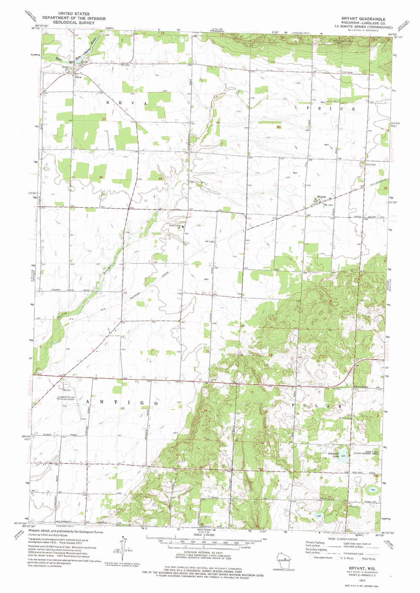
USGS Topo Quad 45089b1 - 1:24,000 scale
| Topo Map Name: | Bryant |
| USGS Topo Quad ID: | 45089b1 |
| Print Size: | ca. 21 1/4" wide x 27" high |
| Southeast Coordinates: | 45.125° N latitude / 89° W longitude |
| Map Center Coordinates: | 45.1875° N latitude / 89.0625° W longitude |
| U.S. State: | WI |
| Filename: | o45089b1.jpg |
| Download Map JPG Image: | Bryant topo map 1:24,000 scale |
| Map Type: | Topographic |
| Topo Series: | 7.5´ |
| Map Scale: | 1:24,000 |
| Source of Map Images: | United States Geological Survey (USGS) |
| Alternate Map Versions: |
Bryant WI 1973, updated 1976 Download PDF Buy paper map Bryant WI 2010 Download PDF Buy paper map Bryant WI 2013 Download PDF Buy paper map Bryant WI 2015 Download PDF Buy paper map |
1:24,000 Topo Quads surrounding Bryant
Enterprise |
Elcho |
Post Lake |
Mole Lake |
Roberts Lake |
Bavaria |
Kempster |
Pearson |
Pickerel |
Lily |
Black Brook |
Antigo |
Bryant |
Polar |
White Lake |
Hogarty |
Aniwa |
Mattoon |
Zoar |
Perote Lake |
Hatley |
Birnamwood |
Regina |
Burney Lake |
Neopit |
> Back to 45089a1 at 1:100,000 scale
> Back to 45088a1 at 1:250,000 scale
> Back to U.S. Topo Maps home
Bryant topo map: Gazetteer
Bryant: Airports
Langlade County Airport elevation 463m 1519′Bryant: Dams
Skinner Dam elevation 470m 1541′Bryant: Lakes
Schmuhl Lake elevation 447m 1466′Bryant: Populated Places
Bryant elevation 484m 1587′Neva elevation 478m 1568′
Bryant: Reservoirs
25 Reservoir elevation 470m 1541′Bryant digital topo map on disk
Buy this Bryant topo map showing relief, roads, GPS coordinates and other geographical features, as a high-resolution digital map file on DVD: