Black Brook Topo Map Wisconsin
To zoom in, hover over the map of Black Brook
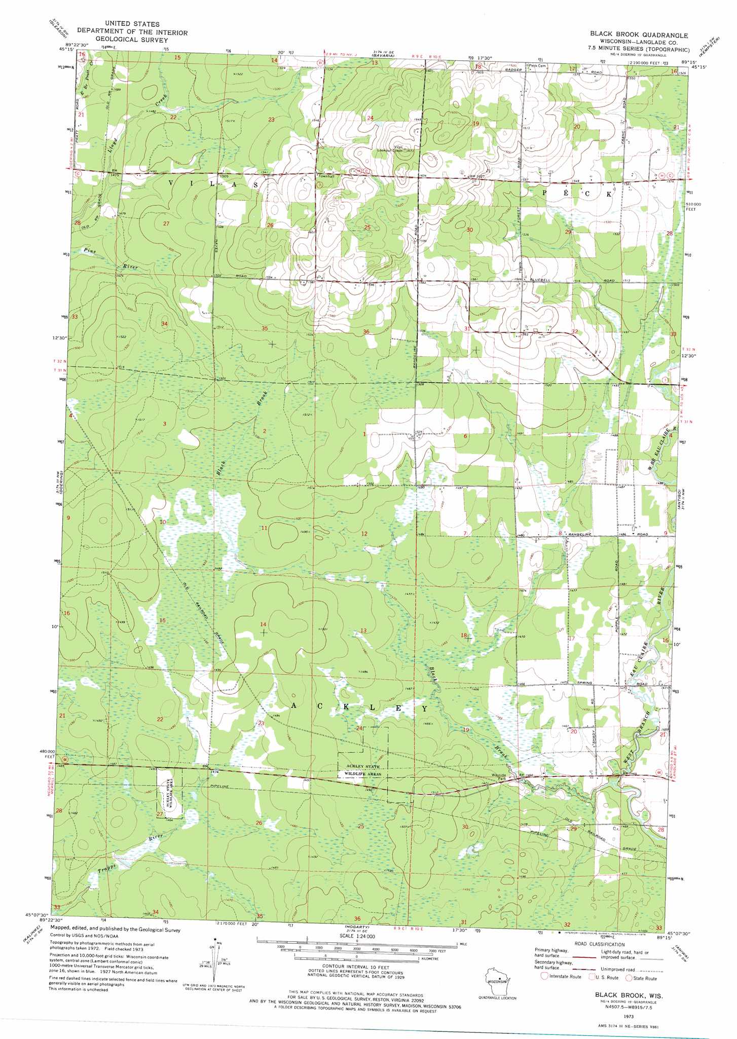
USGS Topo Quad 45089b3 - 1:24,000 scale
| Topo Map Name: | Black Brook |
| USGS Topo Quad ID: | 45089b3 |
| Print Size: | ca. 21 1/4" wide x 27" high |
| Southeast Coordinates: | 45.125° N latitude / 89.25° W longitude |
| Map Center Coordinates: | 45.1875° N latitude / 89.3125° W longitude |
| U.S. State: | WI |
| Filename: | o45089b3.jpg |
| Download Map JPG Image: | Black Brook topo map 1:24,000 scale |
| Map Type: | Topographic |
| Topo Series: | 7.5´ |
| Map Scale: | 1:24,000 |
| Source of Map Images: | United States Geological Survey (USGS) |
| Alternate Map Versions: |
Black Brook WI 1973, updated 1976 Download PDF Buy paper map Black Brook WI 2010 Download PDF Buy paper map Black Brook WI 2013 Download PDF Buy paper map Black Brook WI 2015 Download PDF Buy paper map |
1:24,000 Topo Quads surrounding Black Brook
Harrison |
Parrish |
Enterprise |
Elcho |
Post Lake |
Bloomville |
Gleason |
Bavaria |
Kempster |
Pearson |
Pine Dells |
Doering |
Black Brook |
Antigo |
Bryant |
Nutterville |
Kalinke |
Hogarty |
Aniwa |
Mattoon |
Wausau East |
Ringle |
Hatley |
Birnamwood |
Regina |
> Back to 45089a1 at 1:100,000 scale
> Back to 45088a1 at 1:250,000 scale
> Back to U.S. Topo Maps home
Black Brook topo map: Gazetteer
Black Brook: Dams
Langlade County Flowage T1063 G12 684 Dam elevation 450m 1476′Langlade County Flowage T1063 G12 685 Dam elevation 448m 1469′
Motl 2 G12 121 Dam elevation 444m 1456′
Motl 3 G12 121 Dam elevation 445m 1459′
Black Brook: Reservoirs
1 Reservoir elevation 448m 1469′1 Reservoir elevation 450m 1476′
Black Brook: Streams
Black Brook elevation 441m 1446′Black Brook digital topo map on disk
Buy this Black Brook topo map showing relief, roads, GPS coordinates and other geographical features, as a high-resolution digital map file on DVD: