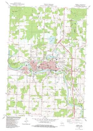
Merrill Topo Map Wisconsin
To zoom in, hover over the map of Merrill
USGS Topo Quad 45089b6 - 1:24,000 scale
| Topo Map Name: | Merrill |
| USGS Topo Quad ID: | 45089b6 |
| Print Size: | ca. 21 1/4" wide x 27" high |
| Southeast Coordinates: | 45.125° N latitude / 89.625° W longitude |
| Map Center Coordinates: | 45.1875° N latitude / 89.6875° W longitude |
| U.S. State: | WI |
| Filename: | o45089b6.jpg |
| Download Map JPG Image: | Merrill topo map 1:24,000 scale |
| Map Type: | Topographic |
| Topo Series: | 7.5´ |
| Map Scale: | 1:24,000 |
| Source of Map Images: | United States Geological Survey (USGS) |
| Alternate Map Versions: |
Merrill WI 1982, updated 1983 Download PDF Buy paper map Merrill WI 2010 Download PDF Buy paper map Merrill WI 2013 Download PDF Buy paper map Merrill WI 2015 Download PDF Buy paper map |
1:24,000 Topo Quads surrounding Merrill
> Back to 45089a1 at 1:100,000 scale
> Back to 45088a1 at 1:250,000 scale
> Back to U.S. Topo Maps home
Merrill topo map: Gazetteer
Merrill: Airports
Merrill Municipal Airport elevation 397m 1302′Merrill: Dams
Merrill 1874C118 Dam elevation 379m 1243′Ward Paper Mill Dam (historical) elevation 386m 1266′
Merrill: Lakes
Gibson Lake elevation 395m 1295′Gospel Lake elevation 399m 1309′
Henrich Lake elevation 387m 1269′
Pesabic Lake elevation 398m 1305′
Merrill: Parks
Council Grounds State Park elevation 395m 1295′Krueger Pines State Natural Area elevation 390m 1279′
Lincoln County Fair Grounds elevation 386m 1266′
Memorial Park elevation 388m 1272′
Otts Park elevation 385m 1263′
Prairie River State Fishery Area elevation 403m 1322′
Riverside Park elevation 379m 1243′
Merrill: Populated Places
Merrill elevation 386m 1266′Merrill: Post Offices
Merrill Post Office elevation 384m 1259′Merrill: Reservoirs
2780 Reservoir elevation 379m 1243′Ward Mill Pond elevation 386m 1266′
Ward Millpond 209 elevation 388m 1272′
Merrill: Streams
Barnes Creek elevation 392m 1286′Black Alder Creek elevation 399m 1309′
Devil Creek elevation 381m 1250′
Little Hay Meadow Creek elevation 393m 1289′
Pine River elevation 370m 1213′
Prairie River elevation 380m 1246′
Merrill digital topo map on disk
Buy this Merrill topo map showing relief, roads, GPS coordinates and other geographical features, as a high-resolution digital map file on DVD:


