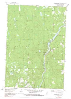
Grandfather Falls Topo Map Wisconsin
To zoom in, hover over the map of Grandfather Falls
USGS Topo Quad 45089c7 - 1:24,000 scale
| Topo Map Name: | Grandfather Falls |
| USGS Topo Quad ID: | 45089c7 |
| Print Size: | ca. 21 1/4" wide x 27" high |
| Southeast Coordinates: | 45.25° N latitude / 89.75° W longitude |
| Map Center Coordinates: | 45.3125° N latitude / 89.8125° W longitude |
| U.S. State: | WI |
| Filename: | o45089c7.jpg |
| Download Map JPG Image: | Grandfather Falls topo map 1:24,000 scale |
| Map Type: | Topographic |
| Topo Series: | 7.5´ |
| Map Scale: | 1:24,000 |
| Source of Map Images: | United States Geological Survey (USGS) |
| Alternate Map Versions: |
Grandfather Falls WI 1978, updated 1978 Download PDF Buy paper map Grandfather Falls WI 1978, updated 1991 Download PDF Buy paper map Grandfather Falls WI 2010 Download PDF Buy paper map Grandfather Falls WI 2013 Download PDF Buy paper map Grandfather Falls WI 2015 Download PDF Buy paper map |
1:24,000 Topo Quads surrounding Grandfather Falls
> Back to 45089a1 at 1:100,000 scale
> Back to 45088a1 at 1:250,000 scale
> Back to U.S. Topo Maps home
Grandfather Falls topo map: Gazetteer
Grandfather Falls: Dams
Grandfather Dam elevation 418m 1371′Upper Grandfather Falls 2WP357 Dam elevation 422m 1384′
Grandfather Falls: Falls
Grandfather Falls elevation 401m 1315′Grandfather Falls: Lakes
Morrison Lake elevation 459m 1505′Grandfather Falls: Parks
Camp New Wood County Park elevation 409m 1341′Grandfather Falls: Rapids
Bill Cross Rapids elevation 389m 1276′Posey Rapids elevation 395m 1295′
Grandfather Falls: Reservoirs
Grandfather Flowage 2295 elevation 422m 1384′Grandfather Falls: Streams
Alery Creek elevation 425m 1394′Averill Creek elevation 420m 1377′
Berry Creek elevation 426m 1397′
Kelly Creek elevation 415m 1361′
Ripley Creek elevation 395m 1295′
Wolf Creek elevation 417m 1368′
Wright Creek elevation 401m 1315′
Grandfather Falls digital topo map on disk
Buy this Grandfather Falls topo map showing relief, roads, GPS coordinates and other geographical features, as a high-resolution digital map file on DVD:


