George Lake Topo Map Wisconsin
To zoom in, hover over the map of George Lake
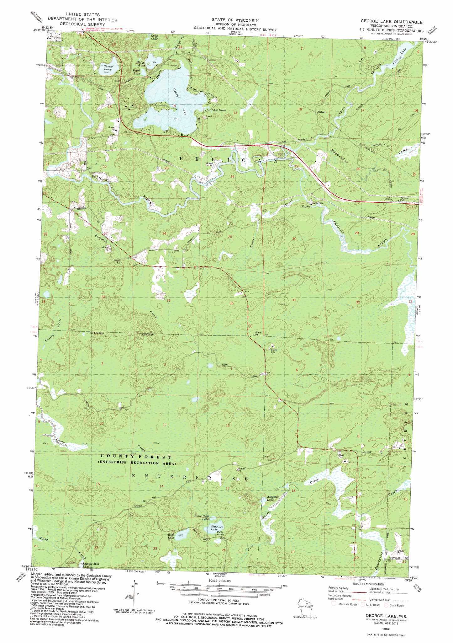
USGS Topo Quad 45089e3 - 1:24,000 scale
| Topo Map Name: | George Lake |
| USGS Topo Quad ID: | 45089e3 |
| Print Size: | ca. 21 1/4" wide x 27" high |
| Southeast Coordinates: | 45.5° N latitude / 89.25° W longitude |
| Map Center Coordinates: | 45.5625° N latitude / 89.3125° W longitude |
| U.S. State: | WI |
| Filename: | o45089e3.jpg |
| Download Map JPG Image: | George Lake topo map 1:24,000 scale |
| Map Type: | Topographic |
| Topo Series: | 7.5´ |
| Map Scale: | 1:24,000 |
| Source of Map Images: | United States Geological Survey (USGS) |
| Alternate Map Versions: |
George Lake WI 1982, updated 1983 Download PDF Buy paper map George Lake WI 2010 Download PDF Buy paper map George Lake WI 2013 Download PDF Buy paper map George Lake WI 2015 Download PDF Buy paper map |
1:24,000 Topo Quads surrounding George Lake
Lake Tomahawk |
Dam Lake |
Sugar Camp |
Three Lakes |
Julia Lake |
Mcnaughton |
Reinlander |
Moen Laek |
Starks |
Monico Ne |
Woodboro |
Lake Julia |
George Lake |
Monico |
Nashville |
Harrison |
Parrish |
Enterprise |
Elcho |
Post Lake |
Bloomville |
Gleason |
Bavaria |
Kempster |
Pearson |
> Back to 45089e1 at 1:100,000 scale
> Back to 45088a1 at 1:250,000 scale
> Back to U.S. Topo Maps home
George Lake topo map: Gazetteer
George Lake: Lakes
Alligator Lake elevation 490m 1607′Bass Lake elevation 495m 1624′
Clear Lake elevation 474m 1555′
Fish Lake elevation 476m 1561′
George Lake elevation 473m 1551′
High Lake elevation 496m 1627′
Little Bass Lake elevation 495m 1624′
Midget Lake elevation 474m 1555′
Perch Lake elevation 478m 1568′
George Lake: Parks
Enterprise Recreation Area elevation 493m 1617′George Lake: Populated Places
Malvern elevation 480m 1574′George Lake: Streams
Beaver Creek elevation 475m 1558′Bergman Creek elevation 473m 1551′
Cuenin Creek elevation 470m 1541′
Haymeadow Creek elevation 475m 1558′
Little George Creek elevation 473m 1551′
Neptune Creek elevation 480m 1574′
North Branch Pelican River elevation 472m 1548′
Pine Needle Creek elevation 486m 1594′
George Lake digital topo map on disk
Buy this George Lake topo map showing relief, roads, GPS coordinates and other geographical features, as a high-resolution digital map file on DVD: