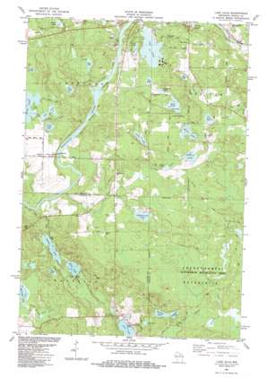
Lake Julia Topo Map Wisconsin
To zoom in, hover over the map of Lake Julia
USGS Topo Quad 45089e4 - 1:24,000 scale
| Topo Map Name: | Lake Julia |
| USGS Topo Quad ID: | 45089e4 |
| Print Size: | ca. 21 1/4" wide x 27" high |
| Southeast Coordinates: | 45.5° N latitude / 89.375° W longitude |
| Map Center Coordinates: | 45.5625° N latitude / 89.4375° W longitude |
| U.S. State: | WI |
| Filename: | o45089e4.jpg |
| Download Map JPG Image: | Lake Julia topo map 1:24,000 scale |
| Map Type: | Topographic |
| Topo Series: | 7.5´ |
| Map Scale: | 1:24,000 |
| Source of Map Images: | United States Geological Survey (USGS) |
| Alternate Map Versions: |
Lake Julia WI 1982, updated 1983 Download PDF Buy paper map Lake Julia WI 2010 Download PDF Buy paper map Lake Julia WI 2013 Download PDF Buy paper map Lake Julia WI 2015 Download PDF Buy paper map |
1:24,000 Topo Quads surrounding Lake Julia
> Back to 45089e1 at 1:100,000 scale
> Back to 45088a1 at 1:250,000 scale
> Back to U.S. Topo Maps home
Lake Julia topo map: Gazetteer
Lake Julia: Channels
Hat Rapids Flowage elevation 465m 1525′Lake Julia: Dams
Hat Rapids 1903c239 Dam elevation 464m 1522′Lake Julia: Lakes
Abel Lake elevation 500m 1640′Alice Lake elevation 480m 1574′
Buck Lake elevation 477m 1564′
Cook Lake elevation 478m 1568′
Cuenin Lake elevation 473m 1551′
Davis Lake elevation 475m 1558′
De Marce Lake elevation 475m 1558′
Emma Lake elevation 479m 1571′
Fawn Lake elevation 484m 1587′
Gillette Lake elevation 497m 1630′
Gross Lake elevation 478m 1568′
Heal Lake elevation 467m 1532′
Hess Lake elevation 481m 1578′
Hilderbrand Lake elevation 483m 1584′
Hilts Lake elevation 479m 1571′
Hixon Lake elevation 477m 1564′
Hoist Lake elevation 482m 1581′
Lake Julia elevation 474m 1555′
Landberg Lake elevation 478m 1568′
Lassig Lake elevation 475m 1558′
Lily Lake elevation 479m 1571′
Loon Lake elevation 476m 1561′
Squaw Lake elevation 479m 1571′
Timber Lake elevation 474m 1555′
Vickham Lake elevation 497m 1630′
Lake Julia: Populated Places
Crescent Corner elevation 484m 1587′Jeffris elevation 509m 1669′
Lake Julia: Reservoirs
Hat Rapids Flowage 1143 elevation 464m 1522′Lake Julia: Streams
Camp Six Creek elevation 487m 1597′Carlson Creek elevation 474m 1555′
Crescent Creek elevation 456m 1496′
Hardell Creek elevation 466m 1528′
Heal Creek elevation 467m 1532′
Lassig Creek elevation 475m 1558′
Little Pine Creek elevation 487m 1597′
Noisy Creek elevation 458m 1502′
Smallpox Creek elevation 493m 1617′
Squaw Creek elevation 457m 1499′
Lake Julia digital topo map on disk
Buy this Lake Julia topo map showing relief, roads, GPS coordinates and other geographical features, as a high-resolution digital map file on DVD:


