Monico Ne Topo Map Wisconsin
To zoom in, hover over the map of Monico Ne
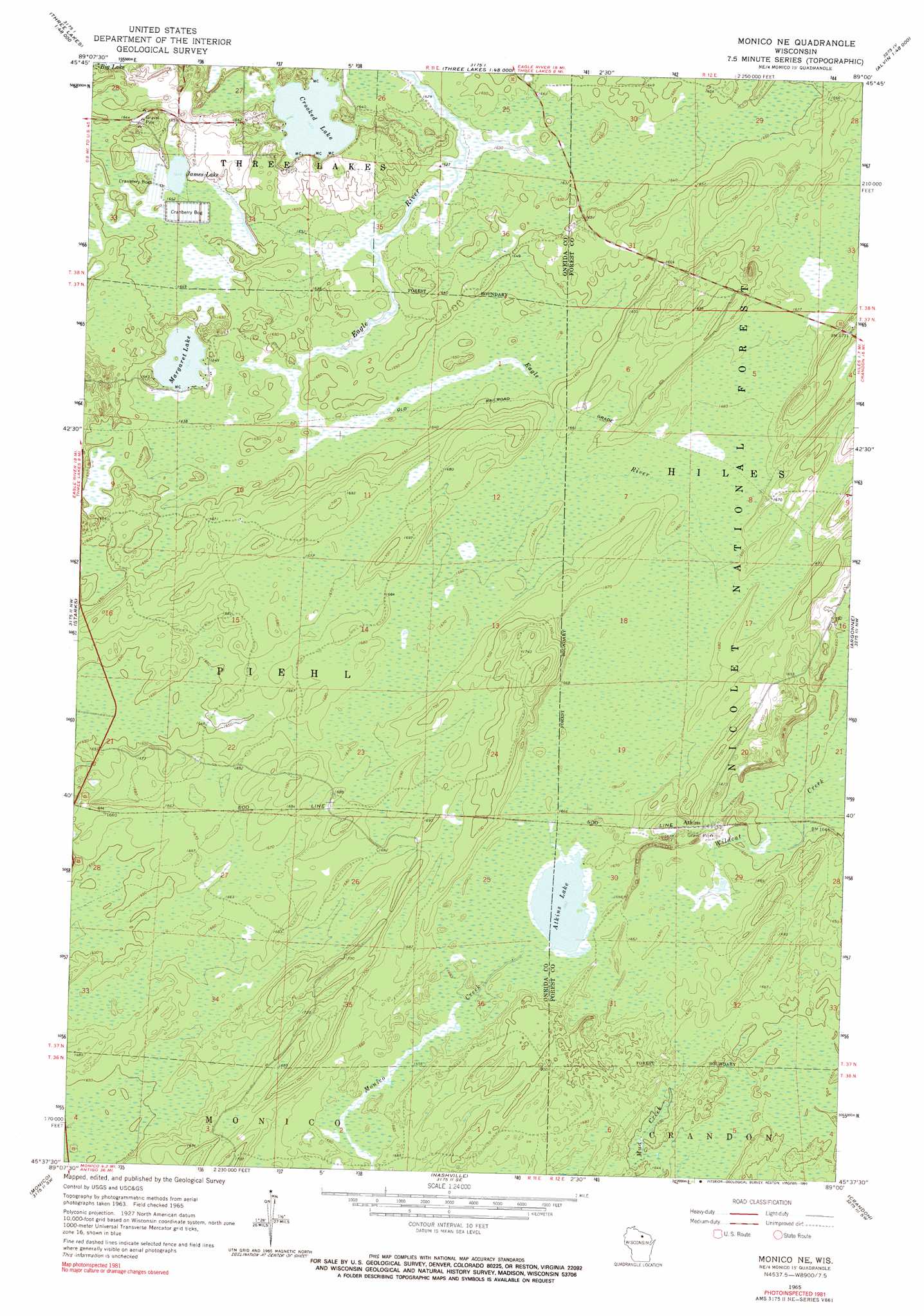
USGS Topo Quad 45089f1 - 1:24,000 scale
| Topo Map Name: | Monico Ne |
| USGS Topo Quad ID: | 45089f1 |
| Print Size: | ca. 21 1/4" wide x 27" high |
| Southeast Coordinates: | 45.625° N latitude / 89° W longitude |
| Map Center Coordinates: | 45.6875° N latitude / 89.0625° W longitude |
| U.S. State: | WI |
| Filename: | o45089f1.jpg |
| Download Map JPG Image: | Monico Ne topo map 1:24,000 scale |
| Map Type: | Topographic |
| Topo Series: | 7.5´ |
| Map Scale: | 1:24,000 |
| Source of Map Images: | United States Geological Survey (USGS) |
| Alternate Map Versions: |
Monico NE WI 1965, updated 1966 Download PDF Buy paper map Monico NE WI 1965, updated 1991 Download PDF Buy paper map Monico NE WI 2011 Download PDF Buy paper map Monico NE WI 2013 Download PDF Buy paper map Monico NE WI 2015 Download PDF Buy paper map |
| FStopo: | US Forest Service topo Monico NE is available: Download FStopo PDF Download FStopo TIF |
1:24,000 Topo Quads surrounding Monico Ne
Eagle River West |
Eagle River East |
Anvil Lake |
Alvin Nw |
Alvin |
Sugar Camp |
Three Lakes |
Julia Lake |
Alvin Sw |
Alvin Se |
Moen Laek |
Starks |
Monico Ne |
Argonne |
Crandon Ne |
George Lake |
Monico |
Nashville |
Crandon |
Lake Lucerne |
Enterprise |
Elcho |
Post Lake |
Mole Lake |
Roberts Lake |
> Back to 45089e1 at 1:100,000 scale
> Back to 45088a1 at 1:250,000 scale
> Back to U.S. Topo Maps home
Monico Ne topo map: Gazetteer
Monico Ne: Lakes
Atkins Lake elevation 507m 1663′Crooked Lake elevation 497m 1630′
James Lake elevation 503m 1650′
Margaret Lake elevation 498m 1633′
Monico Ne: Parks
Atkins Lake State Natural Area elevation 508m 1666′Monico Ne: Populated Places
Atkins elevation 508m 1666′Monico Ne: Reservoirs
Wildcat Creek Impoundment elevation 506m 1660′Monico Ne digital topo map on disk
Buy this Monico Ne topo map showing relief, roads, GPS coordinates and other geographical features, as a high-resolution digital map file on DVD: