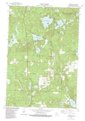
Harshaw Topo Map Wisconsin
To zoom in, hover over the map of Harshaw
USGS Topo Quad 45089f6 - 1:24,000 scale
| Topo Map Name: | Harshaw |
| USGS Topo Quad ID: | 45089f6 |
| Print Size: | ca. 21 1/4" wide x 27" high |
| Southeast Coordinates: | 45.625° N latitude / 89.625° W longitude |
| Map Center Coordinates: | 45.6875° N latitude / 89.6875° W longitude |
| U.S. State: | WI |
| Filename: | o45089f6.jpg |
| Download Map JPG Image: | Harshaw topo map 1:24,000 scale |
| Map Type: | Topographic |
| Topo Series: | 7.5´ |
| Map Scale: | 1:24,000 |
| Source of Map Images: | United States Geological Survey (USGS) |
| Alternate Map Versions: |
Harshaw WI 1982, updated 1983 Download PDF Buy paper map Harshaw WI 2010 Download PDF Buy paper map Harshaw WI 2013 Download PDF Buy paper map Harshaw WI 2015 Download PDF Buy paper map |
1:24,000 Topo Quads surrounding Harshaw
> Back to 45089e1 at 1:100,000 scale
> Back to 45088a1 at 1:250,000 scale
> Back to U.S. Topo Maps home
Harshaw topo map: Gazetteer
Harshaw: Airports
Pinewood Air Park elevation 475m 1558′Harshaw: Channels
Rocky Run Flowage elevation 467m 1532′Harshaw: Lakes
Arneson Lake elevation 478m 1568′Bearskin Lake elevation 469m 1538′
Birch Lake elevation 477m 1564′
Boggy Lake elevation 465m 1525′
Buck Lake elevation 482m 1581′
Burnham Lake elevation 479m 1571′
Campine Lake elevation 465m 1525′
Currie Lake elevation 465m 1525′
East Mitchell Lake elevation 455m 1492′
Fawn Lake elevation 483m 1584′
Heiress Lake elevation 467m 1532′
Indian Lake elevation 466m 1528′
Little Bearskin Lake elevation 468m 1535′
Little Muskie Lake elevation 479m 1571′
Lost Lake elevation 470m 1541′
Muskie Lake elevation 480m 1574′
O'Day Lake elevation 465m 1525′
Oneida Lake elevation 465m 1525′
Perry Lake elevation 466m 1528′
Ruth Lake elevation 482m 1581′
Sand Lake elevation 484m 1587′
Seed Lake elevation 477m 1564′
Simons Lake elevation 478m 1568′
West Mitchell Lake elevation 455m 1492′
Harshaw: Populated Places
Goodnow elevation 460m 1509′Harshaw elevation 459m 1505′
Harshaw: Streams
Bearskin Creek elevation 449m 1473′Horsehead Creek elevation 465m 1525′
Johnson Creek elevation 451m 1479′
Harshaw: Trails
Bearskin State Park Trail elevation 469m 1538′Harshaw digital topo map on disk
Buy this Harshaw topo map showing relief, roads, GPS coordinates and other geographical features, as a high-resolution digital map file on DVD:


