Stetsonville Topo Map Wisconsin
To zoom in, hover over the map of Stetsonville
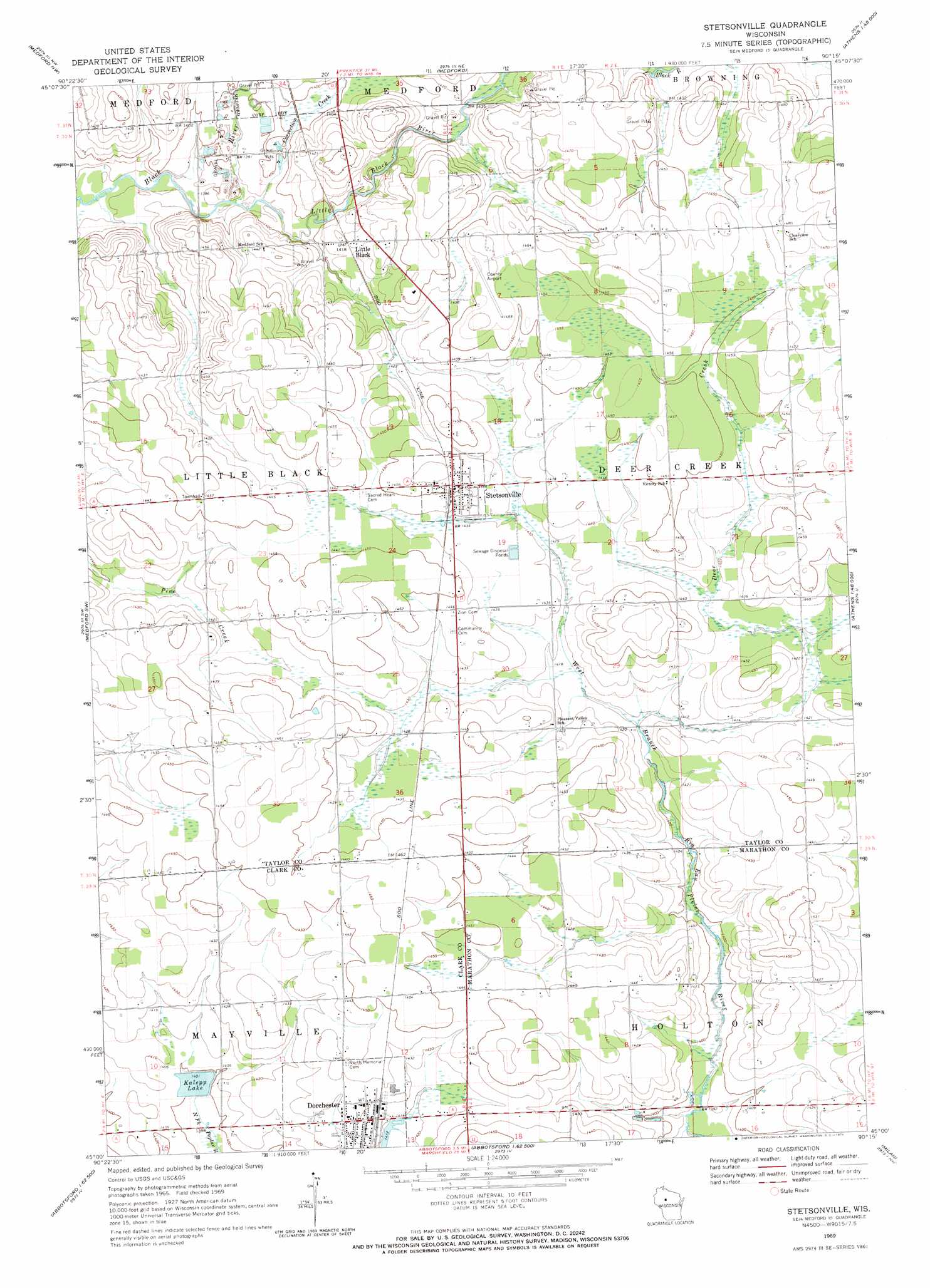
USGS Topo Quad 45090a3 - 1:24,000 scale
| Topo Map Name: | Stetsonville |
| USGS Topo Quad ID: | 45090a3 |
| Print Size: | ca. 21 1/4" wide x 27" high |
| Southeast Coordinates: | 45° N latitude / 90.25° W longitude |
| Map Center Coordinates: | 45.0625° N latitude / 90.3125° W longitude |
| U.S. State: | WI |
| Filename: | o45090a3.jpg |
| Download Map JPG Image: | Stetsonville topo map 1:24,000 scale |
| Map Type: | Topographic |
| Topo Series: | 7.5´ |
| Map Scale: | 1:24,000 |
| Source of Map Images: | United States Geological Survey (USGS) |
| Alternate Map Versions: |
Stetsonville WI 1969, updated 1971 Download PDF Buy paper map Stetsonville WI 2010 Download PDF Buy paper map Stetsonville WI 2013 Download PDF Buy paper map Stetsonville WI 2015 Download PDF Buy paper map |
1:24,000 Topo Quads surrounding Stetsonville
Jump River Fire Tower |
Mondeaux Dam |
Westboro |
Rib Lake |
Wood Lake |
Perkinstown |
Medford Nw |
Medford |
Rib River Lookout Tower |
Goodrich |
Lublin Se |
Medford Sw |
Stetsonville |
Corinth |
Athens |
Owen |
Curtiss |
Abbotsford |
Milan |
Wien |
Greenwood |
Riplinger |
Spencer North |
Little Rose |
Stratford |
> Back to 45090a1 at 1:100,000 scale
> Back to 45090a1 at 1:250,000 scale
> Back to U.S. Topo Maps home
Stetsonville topo map: Gazetteer
Stetsonville: Airports
Taylor County Airport elevation 443m 1453′Stetsonville: Dams
Dorchester G262 Dam elevation 432m 1417′Kalepp Dam elevation 427m 1400′
Stetsonville: Populated Places
Dorchester elevation 435m 1427′Little Black elevation 434m 1423′
Stetsonville elevation 443m 1453′
Stetsonville: Reservoirs
1.25 Reservoir elevation 427m 1400′Kalepp Lake elevation 427m 1400′
Stetsonville: Streams
Correction Creek elevation 424m 1391′Deer Creek elevation 430m 1410′
Little Black River elevation 424m 1391′
Stetsonville digital topo map on disk
Buy this Stetsonville topo map showing relief, roads, GPS coordinates and other geographical features, as a high-resolution digital map file on DVD: