Lublin Se Topo Map Wisconsin
To zoom in, hover over the map of Lublin Se
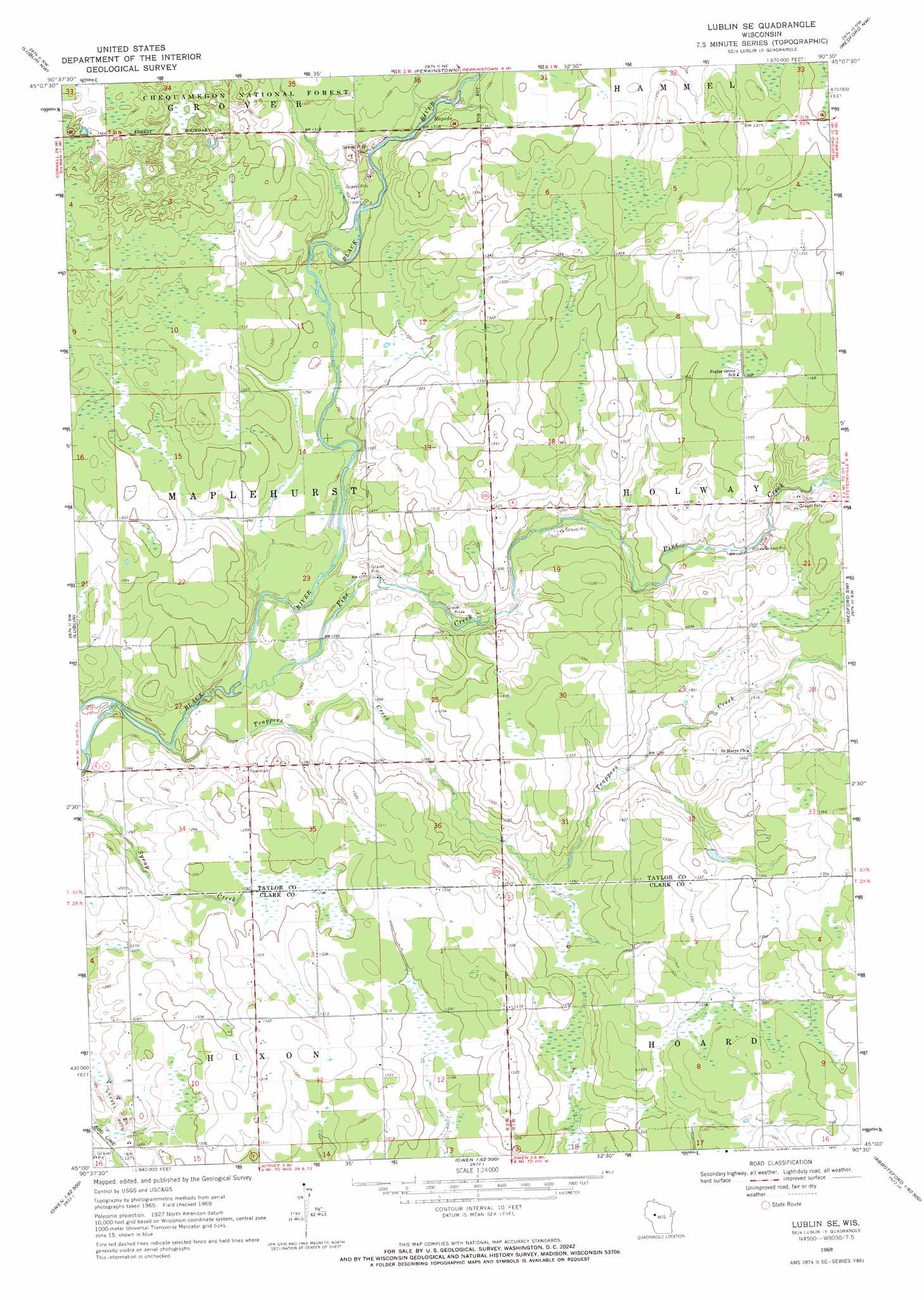
USGS Topo Quad 45090a5 - 1:24,000 scale
| Topo Map Name: | Lublin Se |
| USGS Topo Quad ID: | 45090a5 |
| Print Size: | ca. 21 1/4" wide x 27" high |
| Southeast Coordinates: | 45° N latitude / 90.5° W longitude |
| Map Center Coordinates: | 45.0625° N latitude / 90.5625° W longitude |
| U.S. State: | WI |
| Filename: | o45090a5.jpg |
| Download Map JPG Image: | Lublin Se topo map 1:24,000 scale |
| Map Type: | Topographic |
| Topo Series: | 7.5´ |
| Map Scale: | 1:24,000 |
| Source of Map Images: | United States Geological Survey (USGS) |
| Alternate Map Versions: |
Lublin SE WI 1969, updated 1971 Download PDF Buy paper map Lublin SE WI 2005, updated 2006 Download PDF Buy paper map Lublin SE WI 2011 Download PDF Buy paper map Lublin SE WI 2013 Download PDF Buy paper map Lublin SE WI 2015 Download PDF Buy paper map |
| FStopo: | US Forest Service topo Lublin SE is available: Download FStopo PDF Download FStopo TIF |
1:24,000 Topo Quads surrounding Lublin Se
Jump River |
Jump River Fire Tower Sw |
Jump River Fire Tower |
Mondeaux Dam |
Westboro |
Gilman |
Lublin Nw |
Perkinstown |
Medford Nw |
Medford |
Bellinger |
Lublin |
Lublin Se |
Medford Sw |
Stetsonville |
Thorp |
Lombard |
Owen |
Curtiss |
Abbotsford |
Mead Lake West |
Mead Lake East |
Greenwood |
Riplinger |
Spencer North |
> Back to 45090a1 at 1:100,000 scale
> Back to 45090a1 at 1:250,000 scale
> Back to U.S. Topo Maps home
Lublin Se topo map: Gazetteer
Lublin Se: Streams
Joe Creek elevation 398m 1305′Pine Creek elevation 381m 1250′
Trappers Creek elevation 380m 1246′
Lublin Se digital topo map on disk
Buy this Lublin Se topo map showing relief, roads, GPS coordinates and other geographical features, as a high-resolution digital map file on DVD: