Rib Lake Topo Map Wisconsin
To zoom in, hover over the map of Rib Lake
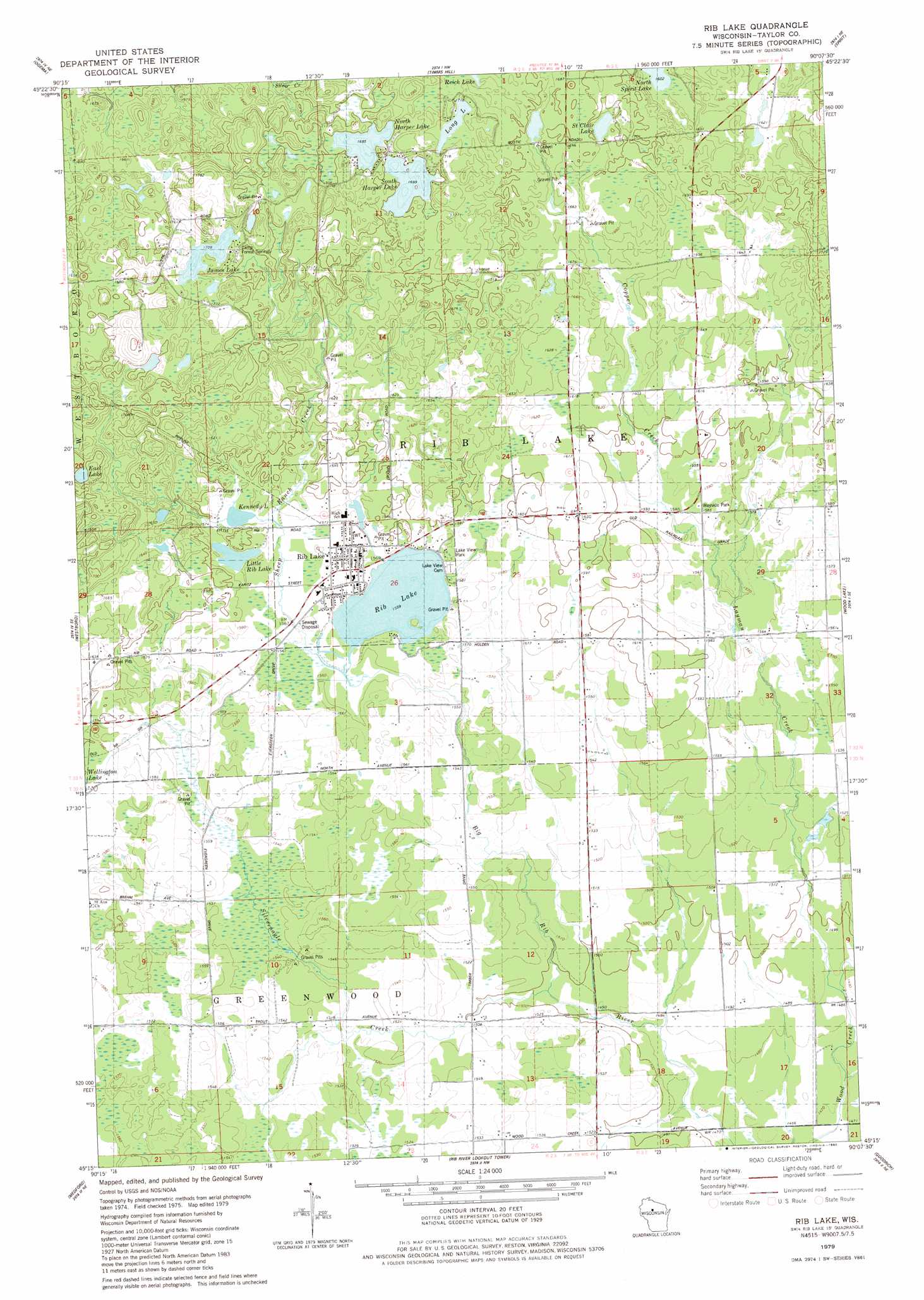
USGS Topo Quad 45090c2 - 1:24,000 scale
| Topo Map Name: | Rib Lake |
| USGS Topo Quad ID: | 45090c2 |
| Print Size: | ca. 21 1/4" wide x 27" high |
| Southeast Coordinates: | 45.25° N latitude / 90.125° W longitude |
| Map Center Coordinates: | 45.3125° N latitude / 90.1875° W longitude |
| U.S. State: | WI |
| Filename: | o45090c2.jpg |
| Download Map JPG Image: | Rib Lake topo map 1:24,000 scale |
| Map Type: | Topographic |
| Topo Series: | 7.5´ |
| Map Scale: | 1:24,000 |
| Source of Map Images: | United States Geological Survey (USGS) |
| Alternate Map Versions: |
Rib Lake WI 1979, updated 1980 Download PDF Buy paper map Rib Lake WI 2010 Download PDF Buy paper map Rib Lake WI 2013 Download PDF Buy paper map Rib Lake WI 2015 Download PDF Buy paper map |
1:24,000 Topo Quads surrounding Rib Lake
Pennington |
Prentice |
Big Briens Lake |
Brantwood |
Tripoli |
Ogema Nw |
Ogema |
Timms Hill |
Spirit |
Spirit Falls |
Mondeaux Dam |
Westboro |
Rib Lake |
Wood Lake |
Natzke Camp |
Medford Nw |
Medford |
Rib River Lookout Tower |
Goodrich |
Fromm Lookout Tower |
Medford Sw |
Stetsonville |
Corinth |
Athens |
Hamburg |
> Back to 45090a1 at 1:100,000 scale
> Back to 45090a1 at 1:250,000 scale
> Back to U.S. Topo Maps home
Rib Lake topo map: Gazetteer
Rib Lake: Dams
Dr Walther W Meyer Number 3 G4914 Dam elevation 517m 1696′Rib Lake: Lakes
East Lake elevation 519m 1702′James Lake elevation 521m 1709′
Kennedy Lake elevation 480m 1574′
Little Rib Lake elevation 480m 1574′
Long Lake elevation 521m 1709′
North Harper Lake elevation 517m 1696′
Rib Lake elevation 475m 1558′
Saint Clair Lake elevation 509m 1669′
South Harper Lake elevation 518m 1699′
Rib Lake: Parks
Lake View Park elevation 482m 1581′Rib Lake: Populated Places
Rib Lake elevation 478m 1568′Rib Lake: Reservoirs
1 Reservoir elevation 517m 1696′Rib Lake: Streams
Copper Creek elevation 482m 1581′Layman Creek elevation 451m 1479′
Porky Creek elevation 447m 1466′
Sheep Ranch Creek elevation 475m 1558′
Silvernagel Creek elevation 454m 1489′
Rib Lake digital topo map on disk
Buy this Rib Lake topo map showing relief, roads, GPS coordinates and other geographical features, as a high-resolution digital map file on DVD: