Ogema Topo Map Wisconsin
To zoom in, hover over the map of Ogema
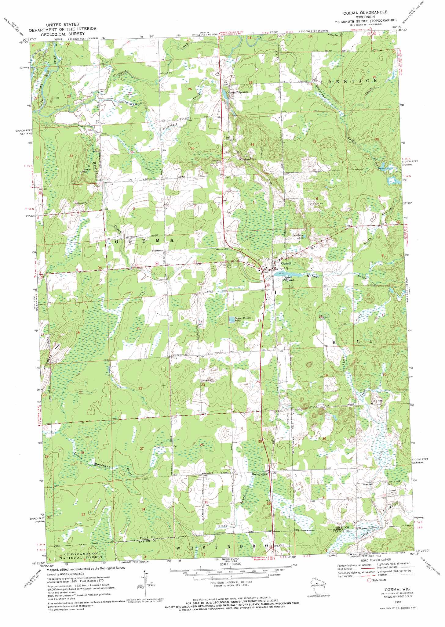
USGS Topo Quad 45090d3 - 1:24,000 scale
| Topo Map Name: | Ogema |
| USGS Topo Quad ID: | 45090d3 |
| Print Size: | ca. 21 1/4" wide x 27" high |
| Southeast Coordinates: | 45.375° N latitude / 90.25° W longitude |
| Map Center Coordinates: | 45.4375° N latitude / 90.3125° W longitude |
| U.S. State: | WI |
| Filename: | o45090d3.jpg |
| Download Map JPG Image: | Ogema topo map 1:24,000 scale |
| Map Type: | Topographic |
| Topo Series: | 7.5´ |
| Map Scale: | 1:24,000 |
| Source of Map Images: | United States Geological Survey (USGS) |
| Alternate Map Versions: |
Ogema WI 1970, updated 1972 Download PDF Buy paper map Ogema WI 2005, updated 2006 Download PDF Buy paper map Ogema WI 2011 Download PDF Buy paper map Ogema WI 2013 Download PDF Buy paper map Ogema WI 2015 Download PDF Buy paper map |
| FStopo: | US Forest Service topo Ogema is available: Download FStopo PDF Download FStopo TIF |
1:24,000 Topo Quads surrounding Ogema
Lac Sault Dore |
Phillips |
Cranberry Lake |
Dover |
Thunder Creek |
Kennan |
Pennington |
Prentice |
Big Briens Lake |
Brantwood |
Jump River Fire Tower Ne |
Ogema Nw |
Ogema |
Timms Hill |
Spirit |
Jump River Fire Tower |
Mondeaux Dam |
Westboro |
Rib Lake |
Wood Lake |
Perkinstown |
Medford Nw |
Medford |
Rib River Lookout Tower |
Goodrich |
> Back to 45090a1 at 1:100,000 scale
> Back to 45090a1 at 1:250,000 scale
> Back to U.S. Topo Maps home
Ogema topo map: Gazetteer
Ogema: Dams
Ogema E3247 Dam elevation 473m 1551′Ogema: Lakes
Lindberg Lake elevation 481m 1578′Ogema: Populated Places
Ogema elevation 483m 1584′Ogema: Reservoirs
5.0 Reservoir elevation 473m 1551′Ogema Millpond elevation 473m 1551′
Ogema: Springs
Ottertail Springs elevation 449m 1473′Ogema: Streams
Alcohol Creek elevation 462m 1515′Douglas Creek elevation 436m 1430′
Golden Creek elevation 466m 1528′
Holmes Creek elevation 436m 1430′
Levitt Creek elevation 455m 1492′
Mondeaux Creek elevation 452m 1482′
North Branch Holmes Creek elevation 476m 1561′
Ottertail Creek elevation 439m 1440′
Ogema: Summits
Hallberg Hill elevation 477m 1564′Ogema digital topo map on disk
Buy this Ogema topo map showing relief, roads, GPS coordinates and other geographical features, as a high-resolution digital map file on DVD: