Ingram Topo Map Wisconsin
To zoom in, hover over the map of Ingram
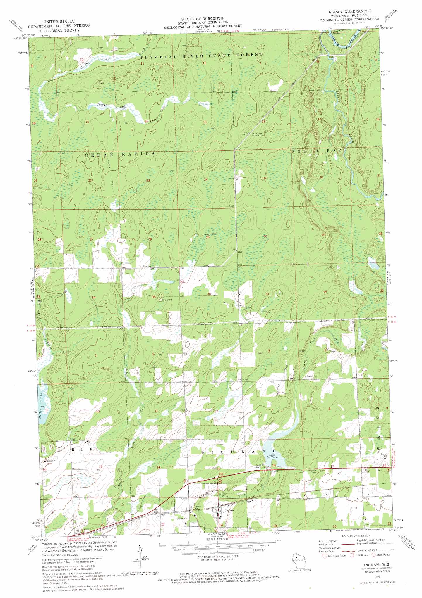
USGS Topo Quad 45090e7 - 1:24,000 scale
| Topo Map Name: | Ingram |
| USGS Topo Quad ID: | 45090e7 |
| Print Size: | ca. 21 1/4" wide x 27" high |
| Southeast Coordinates: | 45.5° N latitude / 90.75° W longitude |
| Map Center Coordinates: | 45.5625° N latitude / 90.8125° W longitude |
| U.S. State: | WI |
| Filename: | o45090e7.jpg |
| Download Map JPG Image: | Ingram topo map 1:24,000 scale |
| Map Type: | Topographic |
| Topo Series: | 7.5´ |
| Map Scale: | 1:24,000 |
| Source of Map Images: | United States Geological Survey (USGS) |
| Alternate Map Versions: |
Ingram WI 1971, updated 1973 Download PDF Buy paper map Ingram WI 2010 Download PDF Buy paper map Ingram WI 2013 Download PDF Buy paper map Ingram WI 2015 Download PDF Buy paper map |
1:24,000 Topo Quads surrounding Ingram
Winter |
Lake Winter |
Babbs Island |
Oxbo |
Lugerville |
Hogsback Creek |
Ingram Nw |
Ingram Ne |
Kennan Nw |
Lac Sault Dore |
Exeland Se |
Big Falls Dam |
Ingram |
Hawkins |
Kennan |
Ladysmith |
Tony |
Sheldon Ne |
Jump River Fire Tower Nw |
Jump River Fire Tower Ne |
Ladysmith Se |
Sheldon |
Jump River |
Jump River Fire Tower Sw |
Jump River Fire Tower |
> Back to 45090e1 at 1:100,000 scale
> Back to 45090a1 at 1:250,000 scale
> Back to U.S. Topo Maps home
Ingram topo map: Gazetteer
Ingram: Dams
Kaiser and Fisher Flowage 2WP1835 Dam elevation 398m 1305′Ingram: Populated Places
Ingram elevation 394m 1292′Ingram: Rapids
Otter Slide Rapids elevation 394m 1292′Ingram: Reservoirs
Lake La Verne 13 elevation 398m 1305′Lake LaVerne elevation 399m 1309′
Ingram: Streams
Skinner Creek elevation 395m 1295′Ingram digital topo map on disk
Buy this Ingram topo map showing relief, roads, GPS coordinates and other geographical features, as a high-resolution digital map file on DVD: