Thunder Creek Topo Map Wisconsin
To zoom in, hover over the map of Thunder Creek
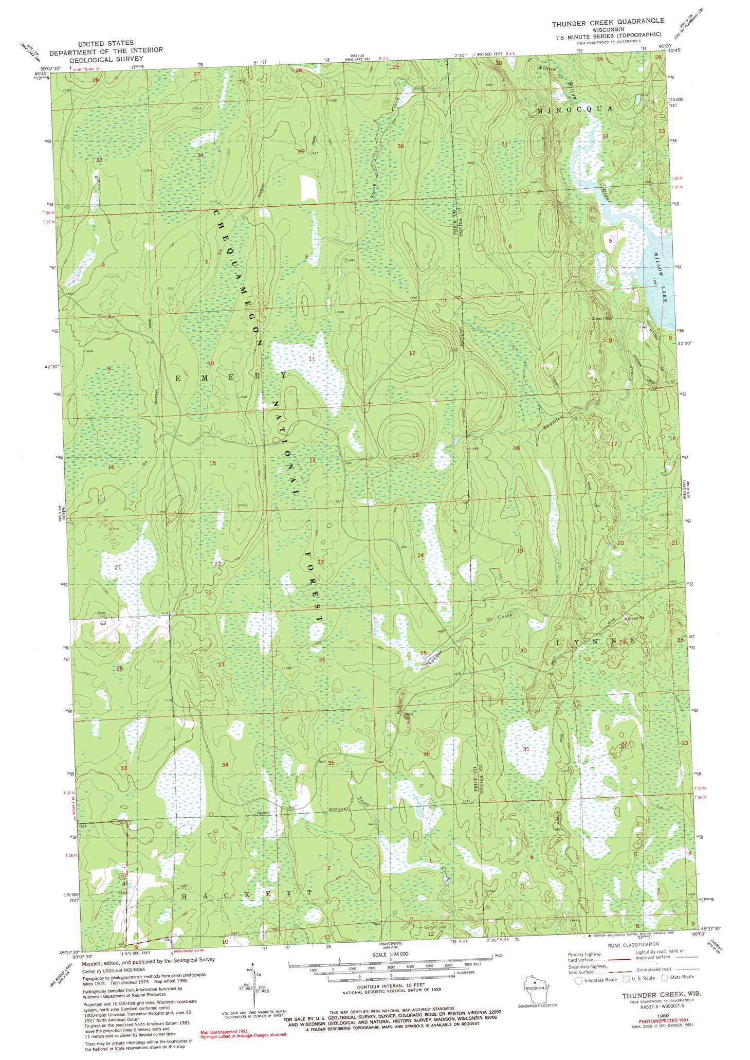
USGS Topo Quad 45090f1 - 1:24,000 scale
| Topo Map Name: | Thunder Creek |
| USGS Topo Quad ID: | 45090f1 |
| Print Size: | ca. 21 1/4" wide x 27" high |
| Southeast Coordinates: | 45.625° N latitude / 90° W longitude |
| Map Center Coordinates: | 45.6875° N latitude / 90.0625° W longitude |
| U.S. State: | WI |
| Filename: | o45090f1.jpg |
| Download Map JPG Image: | Thunder Creek topo map 1:24,000 scale |
| Map Type: | Topographic |
| Topo Series: | 7.5´ |
| Map Scale: | 1:24,000 |
| Source of Map Images: | United States Geological Survey (USGS) |
| Alternate Map Versions: |
Thunder Creek WI 1980, updated 1980 Download PDF Buy paper map Thunder Creek WI 1980, updated 1985 Download PDF Buy paper map Thunder Creek WI 1980, updated 1990 Download PDF Buy paper map Thunder Creek WI 2005, updated 2006 Download PDF Buy paper map Thunder Creek WI 2011 Download PDF Buy paper map Thunder Creek WI 2013 Download PDF Buy paper map Thunder Creek WI 2015 Download PDF Buy paper map |
| FStopo: | US Forest Service topo Thunder Creek is available: Download FStopo PDF Download FStopo TIF |
1:24,000 Topo Quads surrounding Thunder Creek
Blockhouse Lake |
Pike Lake Nw |
Pike Lake |
Lac Du Flambeau |
Fence Lake |
Gates Lake |
Pike Lake Sw |
Pike Lake Se |
Lac Du Flambeau Sw |
Mercer Lake |
Cranberry Lake |
Dover |
Thunder Creek |
Pier Lake |
Burrows Lake |
Prentice |
Big Briens Lake |
Brantwood |
Tripoli |
Bradley |
Ogema |
Timms Hill |
Spirit |
Spirit Falls |
Coffee Creek |
> Back to 45090e1 at 1:100,000 scale
> Back to 45090a1 at 1:250,000 scale
> Back to U.S. Topo Maps home
Thunder Creek topo map: Gazetteer
Thunder Creek: Streams
Little Willow Creek elevation 474m 1555′Thunder Creek elevation 473m 1551′
Thunder Creek digital topo map on disk
Buy this Thunder Creek topo map showing relief, roads, GPS coordinates and other geographical features, as a high-resolution digital map file on DVD: