Pike Lake Se Topo Map Wisconsin
To zoom in, hover over the map of Pike Lake Se
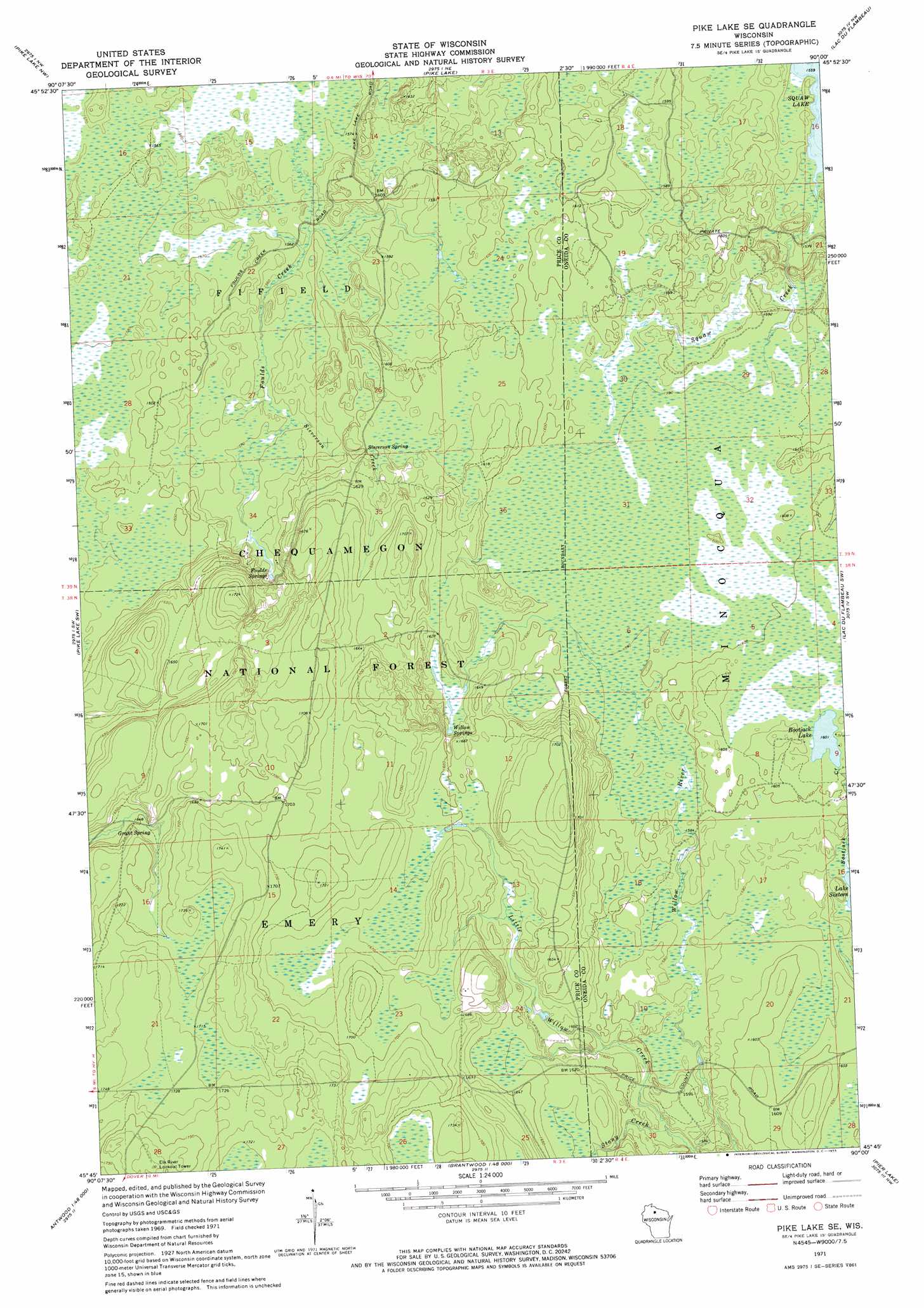
USGS Topo Quad 45090g1 - 1:24,000 scale
| Topo Map Name: | Pike Lake Se |
| USGS Topo Quad ID: | 45090g1 |
| Print Size: | ca. 21 1/4" wide x 27" high |
| Southeast Coordinates: | 45.75° N latitude / 90° W longitude |
| Map Center Coordinates: | 45.8125° N latitude / 90.0625° W longitude |
| U.S. State: | WI |
| Filename: | o45090g1.jpg |
| Download Map JPG Image: | Pike Lake Se topo map 1:24,000 scale |
| Map Type: | Topographic |
| Topo Series: | 7.5´ |
| Map Scale: | 1:24,000 |
| Source of Map Images: | United States Geological Survey (USGS) |
| Alternate Map Versions: |
Pike Lake SE WI 1971, updated 1973 Download PDF Buy paper map Pike Lake SE WI 1971, updated 1985 Download PDF Buy paper map Pike Lake SE WI 2005, updated 2006 Download PDF Buy paper map Pike Lake SE WI 2011 Download PDF Buy paper map Pike Lake SE WI 2013 Download PDF Buy paper map Pike Lake SE WI 2015 Download PDF Buy paper map |
| FStopo: | US Forest Service topo Pike Lake SE is available: Download FStopo PDF Download FStopo TIF |
1:24,000 Topo Quads surrounding Pike Lake Se
Hay Creek Flowage |
Turtle-Flambeau Flowage |
Wilson Lake |
Powell |
Manitowish Lake |
Blockhouse Lake |
Pike Lake Nw |
Pike Lake |
Lac Du Flambeau |
Fence Lake |
Gates Lake |
Pike Lake Sw |
Pike Lake Se |
Lac Du Flambeau Sw |
Mercer Lake |
Cranberry Lake |
Dover |
Thunder Creek |
Pier Lake |
Burrows Lake |
Prentice |
Big Briens Lake |
Brantwood |
Tripoli |
Bradley |
> Back to 45090e1 at 1:100,000 scale
> Back to 45090a1 at 1:250,000 scale
> Back to U.S. Topo Maps home
Pike Lake Se topo map: Gazetteer
Pike Lake Se: Lakes
Bootjack Lake elevation 488m 1601′Pike Lake Se: Springs
Foulds Springs elevation 483m 1584′Grant Spring elevation 499m 1637′
Sieverson Spring elevation 488m 1601′
Willow Springs elevation 493m 1617′
Pike Lake Se: Streams
Sieverson Creek elevation 477m 1564′Stony Creek elevation 476m 1561′
Pike Lake Se digital topo map on disk
Buy this Pike Lake Se topo map showing relief, roads, GPS coordinates and other geographical features, as a high-resolution digital map file on DVD: