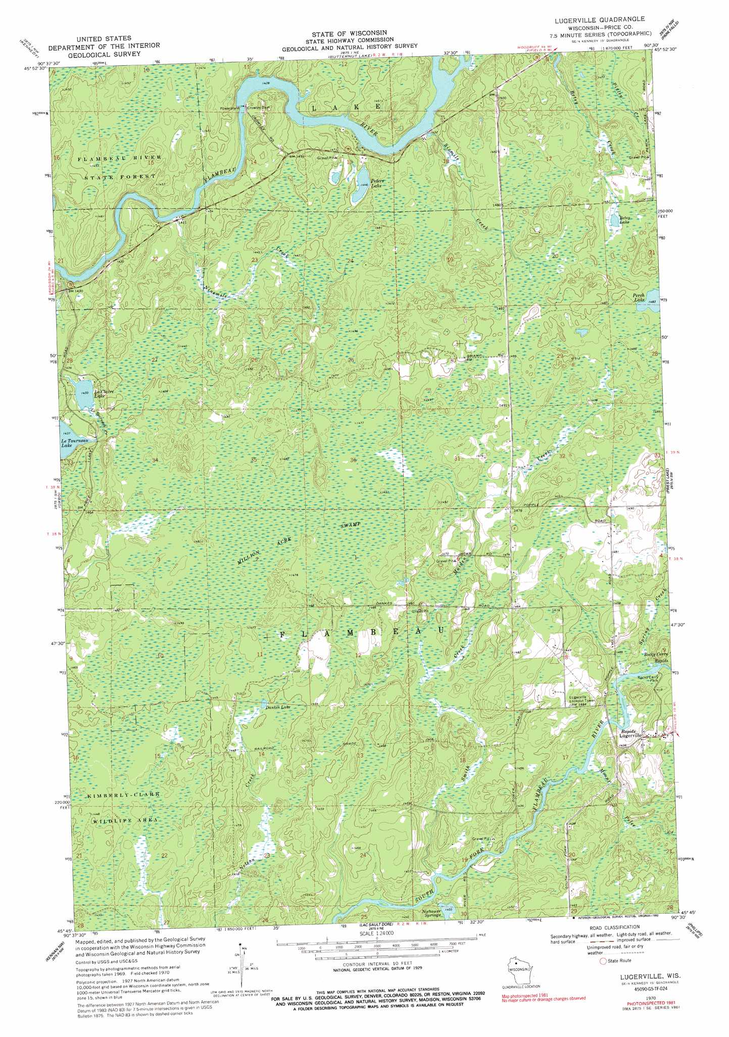
Lugerville Topo Map Wisconsin
To zoom in, hover over the map of Lugerville
USGS Topo Quad 45090g5 - 1:24,000 scale
| Topo Map Name: | Lugerville |
| USGS Topo Quad ID: | 45090g5 |
| Print Size: | ca. 21 1/4" wide x 27" high |
| Southeast Coordinates: | 45.75° N latitude / 90.5° W longitude |
| Map Center Coordinates: | 45.8125° N latitude / 90.5625° W longitude |
| U.S. State: | WI |
| Filename: | o45090g5.jpg |
| Download Map JPG Image: | Lugerville topo map 1:24,000 scale |
| Map Type: | Topographic |
| Topo Series: | 7.5´ |
| Map Scale: | 1:24,000 |
| Source of Map Images: | United States Geological Survey (USGS) |
| Alternate Map Versions: |
Lugerville WI 1970, updated 1972 Download PDF Buy paper map Lugerville WI 1970, updated 1992 Download PDF Buy paper map Lugerville WI 2010 Download PDF Buy paper map Lugerville WI 2013 Download PDF Buy paper map Lugerville WI 2015 Download PDF Buy paper map |
1:24,000 Topo Quads surrounding Lugerville
Clam Lake Se |
Shanagolden |
Peeksville |
Butternut |
Hay Creek Flowage |
Loretta |
Kennedy |
Butternut Lake |
Park Falls |
Blockhouse Lake |
Babbs Island |
Oxbo |
Lugerville |
Priest Lake |
Gates Lake |
Ingram Ne |
Kennan Nw |
Lac Sault Dore |
Phillips |
Cranberry Lake |
Ingram |
Hawkins |
Kennan |
Pennington |
Prentice |
> Back to 45090e1 at 1:100,000 scale
> Back to 45090a1 at 1:250,000 scale
> Back to U.S. Topo Maps home
Lugerville topo map: Gazetteer
Lugerville: Dams
Crowley Dam elevation 434m 1423′Crowley WP381 Dam elevation 430m 1410′
Lugerville: Lakes
Betsy Lake elevation 451m 1479′Dankes Lake elevation 441m 1446′
LeClaire Lake elevation 437m 1433′
Perch Lake elevation 452m 1482′
Peters Lake elevation 442m 1450′
Lugerville: Parks
Rocky Carry Park elevation 430m 1410′Lugerville: Populated Places
Lugerville elevation 440m 1443′Lugerville: Rapids
Rocky Carry Rapids elevation 430m 1410′Lugerville: Reservoirs
Crowley Flowage 802 elevation 430m 1410′Lugerville: Springs
Niebauer Springs elevation 428m 1404′Lugerville: Streams
Le Tourneau Creek elevation 425m 1394′Maiden Creek elevation 435m 1427′
Mount Pelee Creek elevation 428m 1404′
Ninemile Creek elevation 430m 1410′
Sixmile Creek elevation 435m 1427′
Smith Creek elevation 425m 1394′
Spring Creek elevation 430m 1410′
Lugerville: Swamps
Million Acre Swamp elevation 448m 1469′Lugerville digital topo map on disk
Buy this Lugerville topo map showing relief, roads, GPS coordinates and other geographical features, as a high-resolution digital map file on DVD: