Kennedy Topo Map Wisconsin
To zoom in, hover over the map of Kennedy
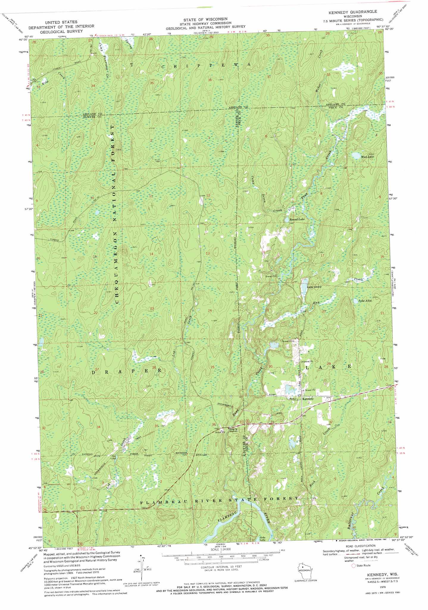
USGS Topo Quad 45090h6 - 1:24,000 scale
| Topo Map Name: | Kennedy |
| USGS Topo Quad ID: | 45090h6 |
| Print Size: | ca. 21 1/4" wide x 27" high |
| Southeast Coordinates: | 45.875° N latitude / 90.625° W longitude |
| Map Center Coordinates: | 45.9375° N latitude / 90.6875° W longitude |
| U.S. State: | WI |
| Filename: | o45090h6.jpg |
| Download Map JPG Image: | Kennedy topo map 1:24,000 scale |
| Map Type: | Topographic |
| Topo Series: | 7.5´ |
| Map Scale: | 1:24,000 |
| Source of Map Images: | United States Geological Survey (USGS) |
| Alternate Map Versions: |
Kennedy WI 1970, updated 1972 Download PDF Buy paper map Kennedy WI 1970, updated 1972 Download PDF Buy paper map Kennedy WI 1970, updated 1992 Download PDF Buy paper map Kennedy WI 2005, updated 2006 Download PDF Buy paper map Kennedy WI 2011 Download PDF Buy paper map Kennedy WI 2013 Download PDF Buy paper map Kennedy WI 2015 Download PDF Buy paper map |
| FStopo: | US Forest Service topo Kennedy is available: Download FStopo PDF Download FStopo TIF |
1:24,000 Topo Quads surrounding Kennedy
Clam Lake |
Clam Lake Ne |
Morse |
Glidden |
Augustine Lake |
Clam Lake Sw |
Clam Lake Se |
Shanagolden |
Peeksville |
Butternut |
Blaisdell Lake |
Loretta |
Kennedy |
Butternut Lake |
Park Falls |
Lake Winter |
Babbs Island |
Oxbo |
Lugerville |
Priest Lake |
Ingram Nw |
Ingram Ne |
Kennan Nw |
Lac Sault Dore |
Phillips |
> Back to 45090e1 at 1:100,000 scale
> Back to 45090a1 at 1:250,000 scale
> Back to U.S. Topo Maps home
Kennedy topo map: Gazetteer
Kennedy: Dams
E A Kemp Number 1 3NW1536.38 Dam elevation 435m 1427′E A Kemp Number 2 3NW1536.38 Dam elevation 451m 1479′
Kennedy: Lakes
Lake Alice elevation 450m 1476′Lake Annie elevation 440m 1443′
Mud Lake elevation 455m 1492′
Round Lake elevation 447m 1466′
Kennedy: Populated Places
Kennedy elevation 449m 1473′Kennedy: Reservoirs
0.2 Reservoir elevation 435m 1427′0.3 Reservoir elevation 451m 1479′
Kennedy: Streams
Camp Seven Creek elevation 440m 1443′Hay Creek elevation 438m 1437′
Pine Creek elevation 420m 1377′
Rock Creek elevation 420m 1377′
Weber Creek elevation 441m 1446′
Kennedy digital topo map on disk
Buy this Kennedy topo map showing relief, roads, GPS coordinates and other geographical features, as a high-resolution digital map file on DVD: