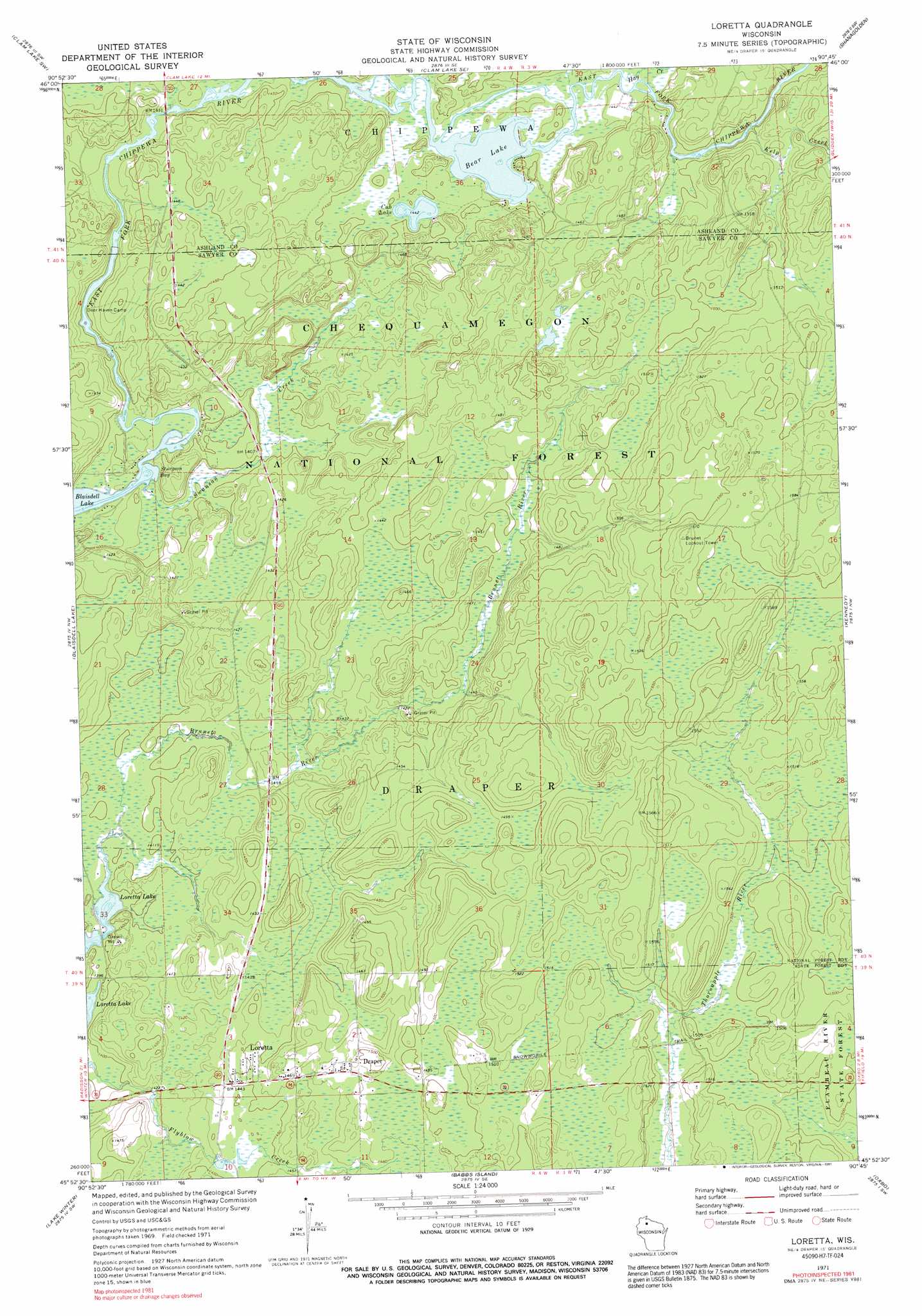
Loretta Topo Map Wisconsin
To zoom in, hover over the map of Loretta
USGS Topo Quad 45090h7 - 1:24,000 scale
| Topo Map Name: | Loretta |
| USGS Topo Quad ID: | 45090h7 |
| Print Size: | ca. 21 1/4" wide x 27" high |
| Southeast Coordinates: | 45.875° N latitude / 90.75° W longitude |
| Map Center Coordinates: | 45.9375° N latitude / 90.8125° W longitude |
| U.S. State: | WI |
| Filename: | o45090h7.jpg |
| Download Map JPG Image: | Loretta topo map 1:24,000 scale |
| Map Type: | Topographic |
| Topo Series: | 7.5´ |
| Map Scale: | 1:24,000 |
| Source of Map Images: | United States Geological Survey (USGS) |
| Alternate Map Versions: |
Loretta WI 1971, updated 1973 Download PDF Buy paper map Loretta WI 1971, updated 1991 Download PDF Buy paper map Loretta WI 2005, updated 2006 Download PDF Buy paper map Loretta WI 2011 Download PDF Buy paper map Loretta WI 2013 Download PDF Buy paper map Loretta WI 2015 Download PDF Buy paper map |
| FStopo: | US Forest Service topo Loretta is available: Download FStopo PDF Download FStopo TIF |
1:24,000 Topo Quads surrounding Loretta
Namekagon Lake |
Clam Lake |
Clam Lake Ne |
Morse |
Glidden |
Moose Lake |
Clam Lake Sw |
Clam Lake Se |
Shanagolden |
Peeksville |
Barker Lake |
Blaisdell Lake |
Loretta |
Kennedy |
Butternut Lake |
Winter |
Lake Winter |
Babbs Island |
Oxbo |
Lugerville |
Hogsback Creek |
Ingram Nw |
Ingram Ne |
Kennan Nw |
Lac Sault Dore |
> Back to 45090e1 at 1:100,000 scale
> Back to 45090a1 at 1:250,000 scale
> Back to U.S. Topo Maps home
Loretta topo map: Gazetteer
Loretta: Bays
Sturgeon Bay elevation 419m 1374′Loretta: Lakes
Bear Lake elevation 437m 1433′Cub Lake elevation 439m 1440′
Loretta: Populated Places
Draper elevation 452m 1482′Loretta elevation 441m 1446′
Loretta: Streams
Flyblow Creek elevation 424m 1391′Hay Creek elevation 438m 1437′
Hungry Run elevation 438m 1437′
Kelp Creek elevation 439m 1440′
Swanson Creek elevation 419m 1374′
Loretta digital topo map on disk
Buy this Loretta topo map showing relief, roads, GPS coordinates and other geographical features, as a high-resolution digital map file on DVD: