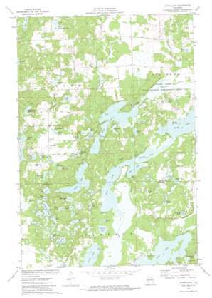
Chain Lake Topo Map Wisconsin
To zoom in, hover over the map of Chain Lake
USGS Topo Quad 45091c4 - 1:24,000 scale
| Topo Map Name: | Chain Lake |
| USGS Topo Quad ID: | 45091c4 |
| Print Size: | ca. 21 1/4" wide x 27" high |
| Southeast Coordinates: | 45.25° N latitude / 91.375° W longitude |
| Map Center Coordinates: | 45.3125° N latitude / 91.4375° W longitude |
| U.S. State: | WI |
| Filename: | o45091c4.jpg |
| Download Map JPG Image: | Chain Lake topo map 1:24,000 scale |
| Map Type: | Topographic |
| Topo Series: | 7.5´ |
| Map Scale: | 1:24,000 |
| Source of Map Images: | United States Geological Survey (USGS) |
| Alternate Map Versions: |
Chain Lake WI 1972, updated 1974 Download PDF Buy paper map Chain Lake WI 2010 Download PDF Buy paper map Chain Lake WI 2013 Download PDF Buy paper map Chain Lake WI 2015 Download PDF Buy paper map |
1:24,000 Topo Quads surrounding Chain Lake
> Back to 45091a1 at 1:100,000 scale
> Back to 45090a1 at 1:250,000 scale
> Back to U.S. Topo Maps home
Chain Lake topo map: Gazetteer
Chain Lake: Channels
The Narrows elevation 328m 1076′Chain Lake: Lakes
Atwood Lake elevation 356m 1167′Axhandle Lake elevation 333m 1092′
Bass Lake elevation 332m 1089′
Bear Lake elevation 352m 1154′
Beauty Lake elevation 375m 1230′
Brush Lake elevation 331m 1085′
Cadotte Lake elevation 334m 1095′
Calkins Lake elevation 327m 1072′
Cather Lake elevation 350m 1148′
Chain Lake elevation 326m 1069′
Chick Lake elevation 344m 1128′
Clear Lake elevation 327m 1072′
Coon Lake elevation 360m 1181′
Dark Lake elevation 334m 1095′
Dead Goose Lake elevation 356m 1167′
Dickey Lake elevation 350m 1148′
Galky Lake elevation 335m 1099′
Granger Lake elevation 328m 1076′
Hogskin Lake elevation 357m 1171′
Hungry Lake elevation 331m 1085′
Jacks Lake elevation 335m 1099′
Lake Four elevation 330m 1082′
Lake One elevation 332m 1089′
Lake Three elevation 330m 1082′
Lake Two elevation 331m 1085′
Leo Joerg Lake elevation 335m 1099′
Little Bass Lake elevation 334m 1095′
Little Bear Lake elevation 353m 1158′
Little Pine Lake elevation 335m 1099′
Long Lake elevation 327m 1072′
Lost Lake elevation 334m 1095′
MacDonald Lake elevation 358m 1174′
Mathy Lake elevation 343m 1125′
McCann Lake elevation 326m 1069′
McDonald Lake elevation 344m 1128′
Muskrat Lake elevation 342m 1122′
North Cummings Lake elevation 397m 1302′
Pine Lake elevation 336m 1102′
Potato Creek Flowage elevation 328m 1076′
Potato Lake elevation 328m 1076′
Rock Lake elevation 356m 1167′
Round Lake elevation 328m 1076′
Ruby Lake elevation 330m 1082′
Rusk Lake elevation 376m 1233′
Schoolhouse Lake elevation 331m 1085′
Silver Lake elevation 333m 1092′
South Cummings Lake elevation 397m 1302′
Star Lake elevation 350m 1148′
Sugar Lake elevation 356m 1167′
Tamarack Lake elevation 332m 1089′
Turk Lake elevation 347m 1138′
Two Bear Lake elevation 360m 1181′
Whiplash Lake elevation 346m 1135′
Chain Lake: Parks
Morris-Erickson County Park elevation 329m 1079′Potato Creek State Wildlife Management Area elevation 328m 1076′
Chain Lake: Streams
Cedar Creek elevation 328m 1076′Cedar Creek elevation 326m 1069′
McDermott Creek elevation 328m 1076′
Chain Lake digital topo map on disk
Buy this Chain Lake topo map showing relief, roads, GPS coordinates and other geographical features, as a high-resolution digital map file on DVD:


