Strickland Topo Map Wisconsin
To zoom in, hover over the map of Strickland
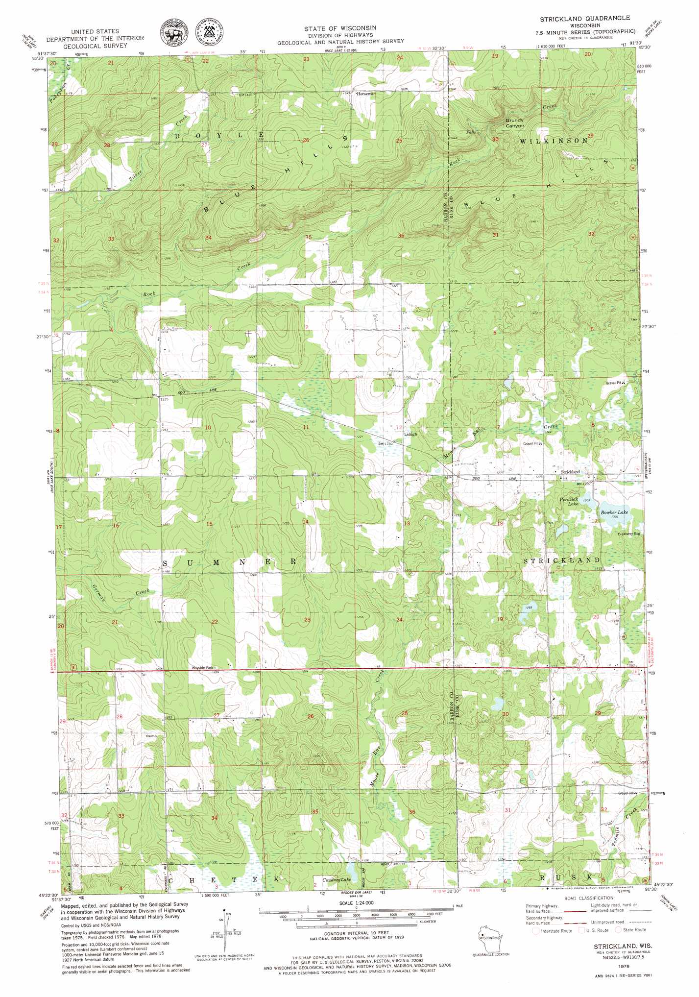
USGS Topo Quad 45091d5 - 1:24,000 scale
| Topo Map Name: | Strickland |
| USGS Topo Quad ID: | 45091d5 |
| Print Size: | ca. 21 1/4" wide x 27" high |
| Southeast Coordinates: | 45.375° N latitude / 91.5° W longitude |
| Map Center Coordinates: | 45.4375° N latitude / 91.5625° W longitude |
| U.S. State: | WI |
| Filename: | o45091d5.jpg |
| Download Map JPG Image: | Strickland topo map 1:24,000 scale |
| Map Type: | Topographic |
| Topo Series: | 7.5´ |
| Map Scale: | 1:24,000 |
| Source of Map Images: | United States Geological Survey (USGS) |
| Alternate Map Versions: |
Strickland WI 1978, updated 1979 Download PDF Buy paper map Strickland WI 2010 Download PDF Buy paper map Strickland WI 2013 Download PDF Buy paper map Strickland WI 2015 Download PDF Buy paper map |
1:24,000 Topo Quads surrounding Strickland
Sarona |
Nobleton |
Birchwood |
Edgewater |
Weirgor |
Haugen |
Rice Lake North |
Mikana |
Bucks Lake |
Becky Creek |
Barron |
Rice Lake South |
Strickland |
Weyerhauser |
Bruce |
Dallas |
Chetek |
Moose Ear Lake |
Chain Lake |
Fireside Lakes |
Ridgeland Ne |
Sand Creek |
New Auburn |
Marsh-Miller Lake |
Bob Lake |
> Back to 45091a1 at 1:100,000 scale
> Back to 45090a1 at 1:250,000 scale
> Back to U.S. Topo Maps home
Strickland topo map: Gazetteer
Strickland: Lakes
Big Bowker Lake elevation 397m 1302′Coudray Lake elevation 346m 1135′
Little Bowker Lake elevation 398m 1305′
Strickland: Parks
Blue Hills Felsenmeer State Natural Area elevation 441m 1446′Rock Creek Felsenmeer State Natural Area elevation 411m 1348′
Strickland: Populated Places
Horseman elevation 476m 1561′Lehigh elevation 375m 1230′
Strickland elevation 390m 1279′
Strickland: Valleys
Gundys Canyon elevation 436m 1430′Strickland digital topo map on disk
Buy this Strickland topo map showing relief, roads, GPS coordinates and other geographical features, as a high-resolution digital map file on DVD: