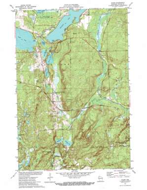
Hauer Topo Map Wisconsin
To zoom in, hover over the map of Hauer
USGS Topo Quad 45091g4 - 1:24,000 scale
| Topo Map Name: | Hauer |
| USGS Topo Quad ID: | 45091g4 |
| Print Size: | ca. 21 1/4" wide x 27" high |
| Southeast Coordinates: | 45.75° N latitude / 91.375° W longitude |
| Map Center Coordinates: | 45.8125° N latitude / 91.4375° W longitude |
| U.S. State: | WI |
| Filename: | o45091g4.jpg |
| Download Map JPG Image: | Hauer topo map 1:24,000 scale |
| Map Type: | Topographic |
| Topo Series: | 7.5´ |
| Map Scale: | 1:24,000 |
| Source of Map Images: | United States Geological Survey (USGS) |
| Alternate Map Versions: |
Hauer WI 1971, updated 1973 Download PDF Buy paper map Hauer WI 2010 Download PDF Buy paper map Hauer WI 2013 Download PDF Buy paper map Hauer WI 2015 Download PDF Buy paper map |
1:24,000 Topo Quads surrounding Hauer
> Back to 45091e1 at 1:100,000 scale
> Back to 45090a1 at 1:250,000 scale
> Back to U.S. Topo Maps home
Hauer topo map: Gazetteer
Hauer: Dams
Billy Boy 2WP232 Dam elevation 390m 1279′Billy Boy Dam elevation 390m 1279′
Sand Lake 2WP826 Dam elevation 398m 1305′
Hauer: Lakes
Buff Lake elevation 402m 1318′Ham Lake elevation 398m 1305′
Hungry Lake elevation 396m 1299′
Lower Holly Lake elevation 396m 1299′
Mud Lake elevation 401m 1315′
Pearce Lake elevation 396m 1299′
Rogers Lake elevation 396m 1299′
Sand Lake elevation 396m 1299′
Summit Lake elevation 397m 1302′
Upper Holly Lake elevation 396m 1299′
Whitefish Lake elevation 392m 1286′
Hauer: Parks
Benson Creek State Wildlife Management Area elevation 383m 1256′Hauer Springs State Wildlife Management Area elevation 401m 1315′
Lac Courte Oreilles State Wildlife Management Area elevation 393m 1289′
Hauer: Populated Places
Hauer elevation 408m 1338′Hauer: Reservoirs
Billy Boy Flowage elevation 391m 1282′Billy Boy Flowage 110 Reservoir elevation 391m 1282′
Sand Lake 22 elevation 398m 1305′
Hauer: Springs
Benson Spring elevation 384m 1259′Lower Hauer Spring elevation 391m 1282′
Hauer: Streams
Alder Creek elevation 386m 1266′Hauer Creek elevation 389m 1276′
Sand Creek elevation 392m 1286′
Summit Creek elevation 387m 1269′
Surette Creek elevation 386m 1266′
Hauer: Swamps
Borns Lake elevation 423m 1387′Hauer digital topo map on disk
Buy this Hauer topo map showing relief, roads, GPS coordinates and other geographical features, as a high-resolution digital map file on DVD:


