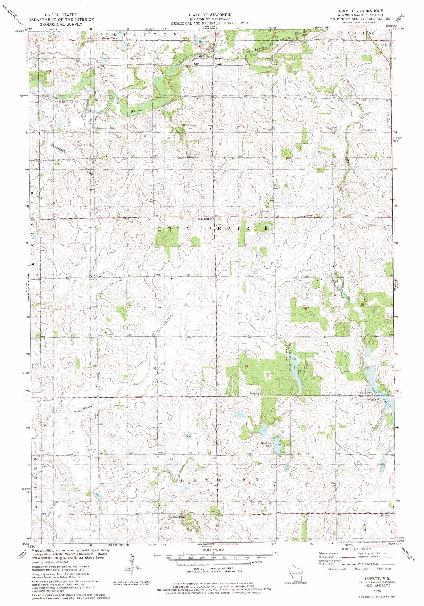
Jewett Topo Map Wisconsin
To zoom in, hover over the map of Jewett
USGS Topo Quad 45092a4 - 1:24,000 scale
| Topo Map Name: | Jewett |
| USGS Topo Quad ID: | 45092a4 |
| Print Size: | ca. 21 1/4" wide x 27" high |
| Southeast Coordinates: | 45° N latitude / 92.375° W longitude |
| Map Center Coordinates: | 45.0625° N latitude / 92.4375° W longitude |
| U.S. State: | WI |
| Filename: | o45092a4.jpg |
| Download Map JPG Image: | Jewett topo map 1:24,000 scale |
| Map Type: | Topographic |
| Topo Series: | 7.5´ |
| Map Scale: | 1:24,000 |
| Source of Map Images: | United States Geological Survey (USGS) |
| Alternate Map Versions: |
Jewett WI 1975, updated 1978 Download PDF Buy paper map Jewett WI 2010 Download PDF Buy paper map Jewett WI 2013 Download PDF Buy paper map Jewett WI 2015 Download PDF Buy paper map |
1:24,000 Topo Quads surrounding Jewett
Osceola |
Nye |
Wapogasset Lake |
Amery |
Clayton |
Somerset North |
New Richmond North |
Deer Park |
Forest |
Graytown |
Somerset South |
New Richmond South |
Jewett |
Emerald |
Glenwood City |
Northline |
Roberts |
Baldwin West |
Baldwin East |
Wilson |
River Falls West |
River Falls East |
Martell |
El Paso |
Spring Valley |
> Back to 45092a1 at 1:100,000 scale
> Back to 45092a1 at 1:250,000 scale
> Back to U.S. Topo Maps home
Jewett topo map: Gazetteer
Jewett: Dams
Borgstrom-Erin Prairie Town G9127 Dam elevation 321m 1053′Jewett: Lakes
Bushnell Lake elevation 337m 1105′Casey Lake elevation 338m 1108′
Goose Pond elevation 304m 997′
Pine Lake elevation 340m 1115′
Jewett: Parks
Casey Lake State Wildlife Area elevation 339m 1112′Jewett: Populated Places
Erin Corner elevation 326m 1069′Jewett elevation 317m 1040′
Jewett: Reservoirs
2 Reservoir elevation 321m 1053′Jewett: Streams
Dry Run elevation 304m 997′South Fork Willow River elevation 303m 994′
Jewett digital topo map on disk
Buy this Jewett topo map showing relief, roads, GPS coordinates and other geographical features, as a high-resolution digital map file on DVD: