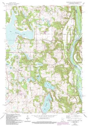
Marine On Saint Croix Topo Map Minnesota
To zoom in, hover over the map of Marine On Saint Croix
USGS Topo Quad 45092b7 - 1:24,000 scale
| Topo Map Name: | Marine On Saint Croix |
| USGS Topo Quad ID: | 45092b7 |
| Print Size: | ca. 21 1/4" wide x 27" high |
| Southeast Coordinates: | 45.125° N latitude / 92.75° W longitude |
| Map Center Coordinates: | 45.1875° N latitude / 92.8125° W longitude |
| U.S. States: | MN, WI |
| Filename: | o45092b7.jpg |
| Download Map JPG Image: | Marine On Saint Croix topo map 1:24,000 scale |
| Map Type: | Topographic |
| Topo Series: | 7.5´ |
| Map Scale: | 1:24,000 |
| Source of Map Images: | United States Geological Survey (USGS) |
| Alternate Map Versions: |
Marine MN 1955, updated 1956 Download PDF Buy paper map Marine on St Croix MN 1967, updated 1969 Download PDF Buy paper map Marine on St Croix MN 1967, updated 1983 Download PDF Buy paper map Marine On St. Croix MN 1967, updated 1993 Download PDF Buy paper map Marine on St. Croix MN 2010 Download PDF Buy paper map Marine on St. Croix MN 2013 Download PDF Buy paper map Marine on St. Croix MN 2016 Download PDF Buy paper map |
1:24,000 Topo Quads surrounding Marine On Saint Croix
> Back to 45092a1 at 1:100,000 scale
> Back to 45092a1 at 1:250,000 scale
> Back to U.S. Topo Maps home
Marine On Saint Croix topo map: Gazetteer
Marine On Saint Croix: Airports
Keller Airport elevation 295m 967′Marine On Saint Croix: Islands
Greenburg Island elevation 207m 679′Marine On Saint Croix: Lakes
Bass Lake elevation 281m 921′Big Carnelian Lake elevation 260m 853′
Big Marine Lake elevation 284m 931′
Clear Lake elevation 275m 902′
East Boot Lake elevation 278m 912′
Fish Lake elevation 287m 941′
Hay Lake elevation 296m 971′
Long Lake elevation 282m 925′
Long Lake elevation 293m 961′
Mays Lake elevation 275m 902′
Mud Lake elevation 287m 941′
Sand Lake elevation 293m 961′
Square Lake elevation 266m 872′
Staples Lake elevation 287m 941′
Terrapin Lake elevation 275m 902′
Turtle Lake elevation 287m 941′
Twin Lakes elevation 252m 826′
West Boot Lake elevation 278m 912′
Marine On Saint Croix: Parks
William O'Brien State Park elevation 244m 800′Marine On Saint Croix: Populated Places
Copas elevation 244m 800′Maple Island elevation 293m 961′
Marine on Saint Croix elevation 228m 748′
Otisville elevation 243m 797′
Marine On Saint Croix: Post Offices
Maple Island Post Office (historical) elevation 293m 961′Marine on Saint Croix Post Office elevation 237m 777′
Otisville Post Office (historical) elevation 242m 793′
Marine On Saint Croix: Reservoirs
Lake Alice elevation 208m 682′Marine On Saint Croix digital topo map on disk
Buy this Marine On Saint Croix topo map showing relief, roads, GPS coordinates and other geographical features, as a high-resolution digital map file on DVD:


