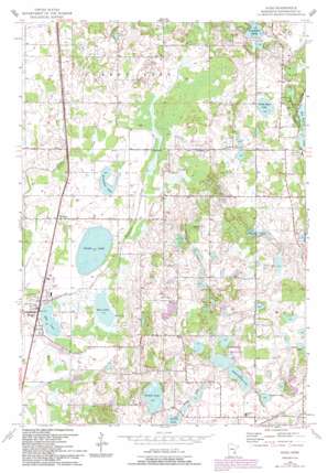
Hugo Topo Map Minnesota
To zoom in, hover over the map of Hugo
USGS Topo Quad 45092b8 - 1:24,000 scale
| Topo Map Name: | Hugo |
| USGS Topo Quad ID: | 45092b8 |
| Print Size: | ca. 21 1/4" wide x 27" high |
| Southeast Coordinates: | 45.125° N latitude / 92.875° W longitude |
| Map Center Coordinates: | 45.1875° N latitude / 92.9375° W longitude |
| U.S. State: | MN |
| Filename: | o45092b8.jpg |
| Download Map JPG Image: | Hugo topo map 1:24,000 scale |
| Map Type: | Topographic |
| Topo Series: | 7.5´ |
| Map Scale: | 1:24,000 |
| Source of Map Images: | United States Geological Survey (USGS) |
| Alternate Map Versions: |
Hugo MN 1954, updated 1956 Download PDF Buy paper map Hugo MN 1954, updated 1965 Download PDF Buy paper map Hugo MN 1967, updated 1969 Download PDF Buy paper map Hugo MN 1967, updated 1981 Download PDF Buy paper map Hugo MN 1967, updated 1993 Download PDF Buy paper map Hugo MN 2010 Download PDF Buy paper map Hugo MN 2013 Download PDF Buy paper map Hugo MN 2016 Download PDF Buy paper map |
1:24,000 Topo Quads surrounding Hugo
> Back to 45092a1 at 1:100,000 scale
> Back to 45092a1 at 1:250,000 scale
> Back to U.S. Topo Maps home
Hugo topo map: Gazetteer
Hugo: Airports
Forest Lake Airport elevation 281m 921′Hugo: Dams
Kelly Farms Dam elevation 301m 987′Hugo: Lakes
Barker Lake elevation 297m 974′Egg Lake elevation 282m 925′
Goggins Lake elevation 291m 954′
Halfbreed Lake elevation 284m 931′
Horseshoe Lake elevation 281m 921′
Long Lake elevation 293m 961′
Lynch Lake elevation 305m 1000′
North School Section Lake elevation 293m 961′
Oneka Lake elevation 281m 921′
Plaisted Lake elevation 293m 961′
Rice Lake elevation 278m 912′
Round Lake elevation 290m 951′
School Section Lake elevation 290m 951′
Sunset Lake elevation 293m 961′
White Rock Lake elevation 291m 954′
Hugo: Populated Places
Hugo elevation 284m 931′Twin Pine Mobile Home Park elevation 284m 931′
Weston elevation 284m 931′
Hugo: Post Offices
Hugo Post Office elevation 284m 931′Hugo: Reservoirs
Maple Marsh Lake elevation 301m 987′Hugo digital topo map on disk
Buy this Hugo topo map showing relief, roads, GPS coordinates and other geographical features, as a high-resolution digital map file on DVD:


