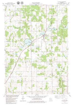
Clayton Topo Map Wisconsin
To zoom in, hover over the map of Clayton
USGS Topo Quad 45092c2 - 1:24,000 scale
| Topo Map Name: | Clayton |
| USGS Topo Quad ID: | 45092c2 |
| Print Size: | ca. 21 1/4" wide x 27" high |
| Southeast Coordinates: | 45.25° N latitude / 92.125° W longitude |
| Map Center Coordinates: | 45.3125° N latitude / 92.1875° W longitude |
| U.S. State: | WI |
| Filename: | o45092c2.jpg |
| Download Map JPG Image: | Clayton topo map 1:24,000 scale |
| Map Type: | Topographic |
| Topo Series: | 7.5´ |
| Map Scale: | 1:24,000 |
| Source of Map Images: | United States Geological Survey (USGS) |
| Alternate Map Versions: |
Clayton WI 1978, updated 1979 Download PDF Buy paper map Clayton WI 2010 Download PDF Buy paper map Clayton WI 2013 Download PDF Buy paper map Clayton WI 2015 Download PDF Buy paper map |
1:24,000 Topo Quads surrounding Clayton
> Back to 45092a1 at 1:100,000 scale
> Back to 45092a1 at 1:250,000 scale
> Back to U.S. Topo Maps home
Clayton topo map: Gazetteer
Clayton: Lakes
Barbo Lake elevation 363m 1190′Bass Lake elevation 391m 1282′
Camelia Lake elevation 366m 1200′
Gilbert Lake elevation 370m 1213′
Greeley Lake elevation 363m 1190′
Little Moon Lake elevation 360m 1181′
Long Lake elevation 358m 1174′
Magnor Lake elevation 363m 1190′
Marsh Lake elevation 363m 1190′
Mud Lake elevation 364m 1194′
Paulson Lake elevation 363m 1190′
Clayton: Populated Places
Clayton elevation 369m 1210′Joel elevation 349m 1145′
Richardson elevation 366m 1200′
Clayton: Streams
Nepadoggen Creek elevation 342m 1122′Clayton digital topo map on disk
Buy this Clayton topo map showing relief, roads, GPS coordinates and other geographical features, as a high-resolution digital map file on DVD:


