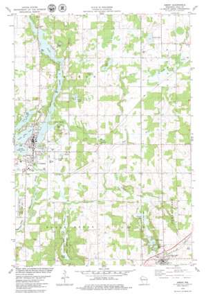
Amery Topo Map Wisconsin
To zoom in, hover over the map of Amery
USGS Topo Quad 45092c3 - 1:24,000 scale
| Topo Map Name: | Amery |
| USGS Topo Quad ID: | 45092c3 |
| Print Size: | ca. 21 1/4" wide x 27" high |
| Southeast Coordinates: | 45.25° N latitude / 92.25° W longitude |
| Map Center Coordinates: | 45.3125° N latitude / 92.3125° W longitude |
| U.S. State: | WI |
| Filename: | o45092c3.jpg |
| Download Map JPG Image: | Amery topo map 1:24,000 scale |
| Map Type: | Topographic |
| Topo Series: | 7.5´ |
| Map Scale: | 1:24,000 |
| Source of Map Images: | United States Geological Survey (USGS) |
| Alternate Map Versions: |
Balsam Lake SE WI 1974, updated 1976 Download PDF Buy paper map Amery WI 1978, updated 1979 Download PDF Buy paper map Amery WI 2010 Download PDF Buy paper map Amery WI 2013 Download PDF Buy paper map Amery WI 2015 Download PDF Buy paper map |
1:24,000 Topo Quads surrounding Amery
> Back to 45092a1 at 1:100,000 scale
> Back to 45092a1 at 1:250,000 scale
> Back to U.S. Topo Maps home
Amery topo map: Gazetteer
Amery: Dams
Amery 3WR1627 Dam elevation 326m 1069′Amery: Lakes
Clear Lake elevation 345m 1131′French Lake elevation 342m 1122′
Gorres Lake elevation 339m 1112′
Ice House Lake elevation 345m 1131′
Jim Lake elevation 342m 1122′
Lincoln Lake elevation 327m 1072′
North Twin Lake elevation 324m 1062′
Omer Lake elevation 334m 1095′
Palmer Lake elevation 345m 1131′
Pike Lake elevation 324m 1062′
Snake Lake elevation 324m 1062′
South Twin Lake elevation 324m 1062′
Amery: Parks
Clear Lake Village Park elevation 344m 1128′Snake Creek State Public Fishing Area elevation 329m 1079′
Amery: Populated Places
Amery elevation 326m 1069′Clear Lake elevation 364m 1194′
Amery: Reservoirs
Apple River Flowage 134 elevation 326m 1069′Amery: Streams
Beaver Brook elevation 324m 1062′Bull Brook elevation 319m 1046′
Burns Creek elevation 324m 1062′
French Creek elevation 329m 1079′
North Branch Beaver Brook elevation 341m 1118′
Snake Creek elevation 325m 1066′
South Branch Beaver Brook elevation 340m 1115′
Amery digital topo map on disk
Buy this Amery topo map showing relief, roads, GPS coordinates and other geographical features, as a high-resolution digital map file on DVD:


