Centuria Topo Map Wisconsin
To zoom in, hover over the map of Centuria
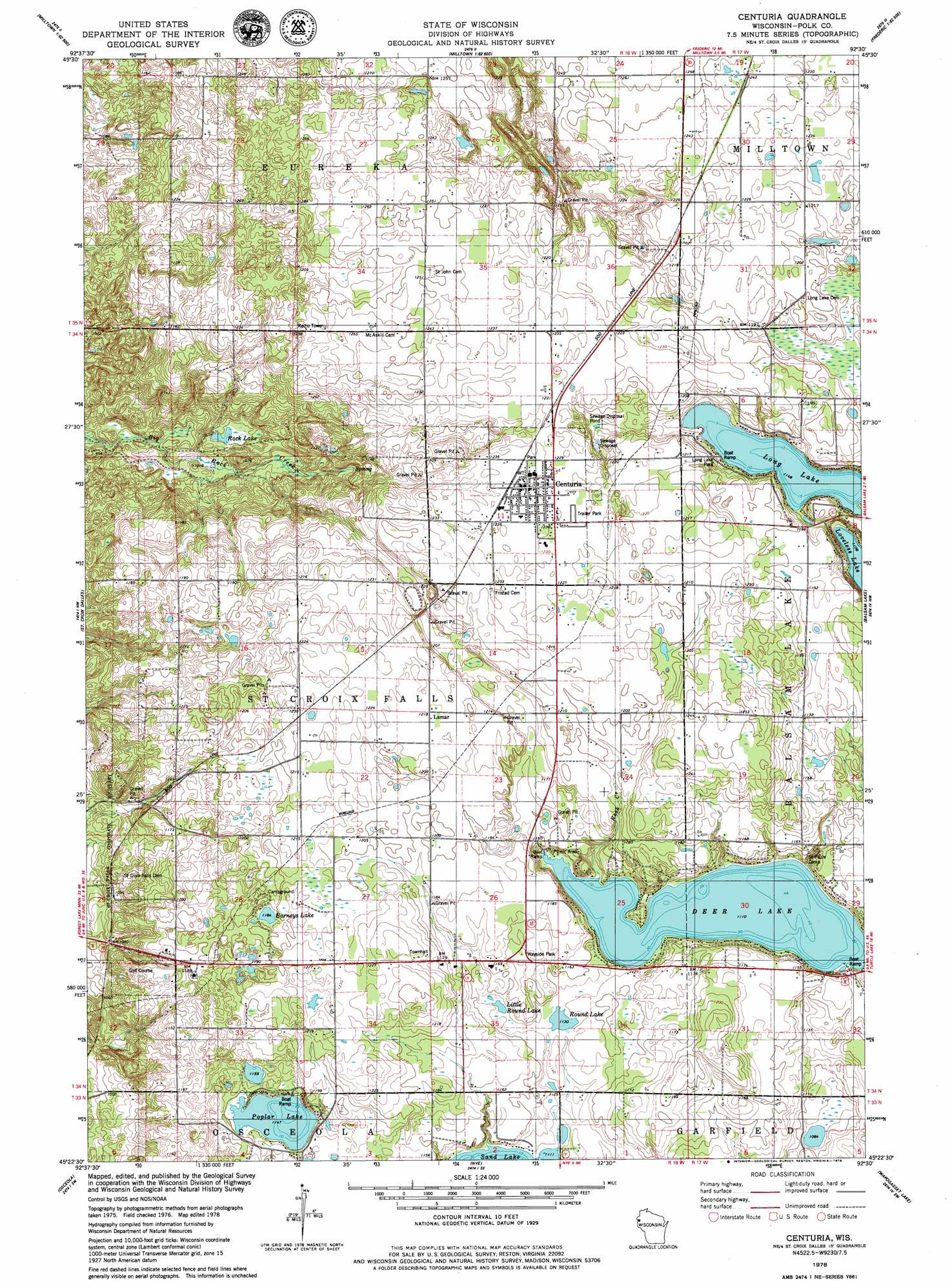
USGS Topo Quad 45092d5 - 1:24,000 scale
| Topo Map Name: | Centuria |
| USGS Topo Quad ID: | 45092d5 |
| Print Size: | ca. 21 1/4" wide x 27" high |
| Southeast Coordinates: | 45.375° N latitude / 92.5° W longitude |
| Map Center Coordinates: | 45.4375° N latitude / 92.5625° W longitude |
| U.S. State: | WI |
| Filename: | o45092d5.jpg |
| Download Map JPG Image: | Centuria topo map 1:24,000 scale |
| Map Type: | Topographic |
| Topo Series: | 7.5´ |
| Map Scale: | 1:24,000 |
| Source of Map Images: | United States Geological Survey (USGS) |
| Alternate Map Versions: |
St. Croix Dalles NE WI 1974, updated 1976 Download PDF Buy paper map Centuria WI 1978, updated 1979 Download PDF Buy paper map Centuria WI 2010 Download PDF Buy paper map Centuria WI 2013 Download PDF Buy paper map Centuria WI 2015 Download PDF Buy paper map |
1:24,000 Topo Quads surrounding Centuria
Randall |
Trade River |
Trade Lake |
Frederic |
Clam Falls |
Sunrise |
Cushing |
Milltown |
Luck |
Big Round Lake |
Lindstrom |
Saint Croix Dalles |
Centuria |
Balsam Lake |
Range |
Scandia |
Osceola |
Nye |
Wapogasset Lake |
Amery |
Marine On Saint Croix |
Somerset North |
New Richmond North |
Deer Park |
Forest |
> Back to 45092a1 at 1:100,000 scale
> Back to 45092a1 at 1:250,000 scale
> Back to U.S. Topo Maps home
Centuria topo map: Gazetteer
Centuria: Lakes
Barneys Lake elevation 361m 1184′Deer Lake elevation 339m 1112′
Little Round Lake elevation 346m 1135′
Long Lake elevation 348m 1141′
Poplar Lake elevation 349m 1145′
Rock Lake elevation 308m 1010′
Round Lake elevation 344m 1128′
Centuria: Parks
Long Lake Park elevation 356m 1167′Centuria: Populated Places
Centuria elevation 375m 1230′Lamar elevation 371m 1217′
Centuria: Streams
Rock Creek elevation 339m 1112′Centuria digital topo map on disk
Buy this Centuria topo map showing relief, roads, GPS coordinates and other geographical features, as a high-resolution digital map file on DVD: