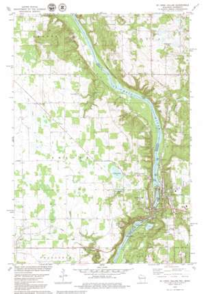
Saint Croix Dalles Topo Map Minnesota
To zoom in, hover over the map of Saint Croix Dalles
USGS Topo Quad 45092d6 - 1:24,000 scale
| Topo Map Name: | Saint Croix Dalles |
| USGS Topo Quad ID: | 45092d6 |
| Print Size: | ca. 21 1/4" wide x 27" high |
| Southeast Coordinates: | 45.375° N latitude / 92.625° W longitude |
| Map Center Coordinates: | 45.4375° N latitude / 92.6875° W longitude |
| U.S. States: | MN, WI |
| Filename: | o45092d6.jpg |
| Download Map JPG Image: | Saint Croix Dalles topo map 1:24,000 scale |
| Map Type: | Topographic |
| Topo Series: | 7.5´ |
| Map Scale: | 1:24,000 |
| Source of Map Images: | United States Geological Survey (USGS) |
| Alternate Map Versions: |
St Croix Dalles NW WI 1974, updated 1976 Download PDF Buy paper map St. Croix Dalles WI 1978, updated 1979 Download PDF Buy paper map St. Croix Dalles WI 1978, updated 1979 Download PDF Buy paper map Saint Croix Dalles WI 2010 Download PDF Buy paper map Saint Croix Dalles WI 2013 Download PDF Buy paper map Saint Croix Dalles WI 2015 Download PDF Buy paper map |
1:24,000 Topo Quads surrounding Saint Croix Dalles
> Back to 45092a1 at 1:100,000 scale
> Back to 45092a1 at 1:250,000 scale
> Back to U.S. Topo Maps home
Saint Croix Dalles topo map: Gazetteer
Saint Croix Dalles: Airports
Beskar Airport elevation 271m 889′Taylors Falls Airport elevation 277m 908′
Saint Croix Dalles: Dams
Saint Croix Falls 1903-C24 Dam elevation 208m 682′Saint Croix Dalles: Islands
Clark Island elevation 210m 688′Folsom Island elevation 210m 688′
Saint Croix Dalles: Lakes
Beede Lake elevation 283m 928′Colby Lake elevation 278m 912′
Lake O' the Dalles elevation 212m 695′
Legoo Lake elevation 265m 869′
Tuttle Lake elevation 291m 954′
Wyckstrom Lake elevation 281m 921′
Saint Croix Dalles: Parks
Centennial Bedrock Glade State Natural Area elevation 271m 889′Dalles of the Saint Croix River State Natural Area elevation 252m 826′
Folsom House Historical Marker elevation 228m 748′
Franconia Sculpture Park elevation 278m 912′
Geology of the Taylor Falls Region Historical Marker elevation 232m 761′
Glacial Potholes Historical Marker elevation 228m 748′
Interstate Lowland Forest State Natural Area elevation 210m 688′
Interstate State Park elevation 270m 885′
Interstate State Park elevation 222m 728′
Lions Park elevation 234m 767′
State Entry Sign (New) US 8 Wayside Park elevation 227m 744′
State Entry Sign (Old) US 8 Wayside Park elevation 227m 744′
Taylor Falls Overlook - South elevation 232m 761′
Taylor Falls Wayside Park elevation 232m 761′
Saint Croix Dalles: Populated Places
Palmdale elevation 285m 935′Redfield Court Mobile Home Park elevation 287m 941′
Saint Croix Falls elevation 282m 925′
Shafer elevation 287m 941′
South Terrace Mobile Home Park elevation 287m 941′
Taylors Falls elevation 229m 751′
Saint Croix Dalles: Post Offices
Palmdale Post Office (historical) elevation 285m 935′Shafer Post Office elevation 287m 941′
Taylors Falls Post Office elevation 228m 748′
Saint Croix Dalles: Reservoirs
Indian Head Flowage 5930 elevation 208m 682′Saint Croix Dalles: Streams
Big Rock Creek elevation 229m 751′Dry Creek elevation 229m 751′
Saint Croix Dalles: Summits
Wild Mountain elevation 307m 1007′Saint Croix Dalles: Valleys
Saint Croix Dalles elevation 208m 682′Saint Croix Dalles digital topo map on disk
Buy this Saint Croix Dalles topo map showing relief, roads, GPS coordinates and other geographical features, as a high-resolution digital map file on DVD:


