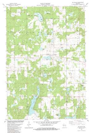
Mckinley Topo Map Wisconsin
To zoom in, hover over the map of Mckinley
USGS Topo Quad 45092e2 - 1:24,000 scale
| Topo Map Name: | Mckinley |
| USGS Topo Quad ID: | 45092e2 |
| Print Size: | ca. 21 1/4" wide x 27" high |
| Southeast Coordinates: | 45.5° N latitude / 92.125° W longitude |
| Map Center Coordinates: | 45.5625° N latitude / 92.1875° W longitude |
| U.S. State: | WI |
| Filename: | o45092e2.jpg |
| Download Map JPG Image: | Mckinley topo map 1:24,000 scale |
| Map Type: | Topographic |
| Topo Series: | 7.5´ |
| Map Scale: | 1:24,000 |
| Source of Map Images: | United States Geological Survey (USGS) |
| Alternate Map Versions: |
Mc Kinley WI 1982, updated 1983 Download PDF Buy paper map McKinley WI 2010 Download PDF Buy paper map McKinley WI 2013 Download PDF Buy paper map McKinley WI 2015 Download PDF Buy paper map |
1:24,000 Topo Quads surrounding Mckinley
> Back to 45092e1 at 1:100,000 scale
> Back to 45092a1 at 1:250,000 scale
> Back to U.S. Topo Maps home
Mckinley topo map: Gazetteer
Mckinley: Airports
Morts Landing Airport elevation 381m 1250′Mckinley: Lakes
Blueberry Lake elevation 390m 1279′Deer Lake elevation 393m 1289′
Ember Lake elevation 385m 1263′
Grenquist Lake elevation 382m 1253′
Grouse Lake elevation 385m 1263′
Highland Lake elevation 394m 1292′
Johnson Lake elevation 382m 1253′
Kelleys Lake elevation 400m 1312′
Lake of the Woods elevation 384m 1259′
Largon Lake elevation 379m 1243′
Little Largon Lake elevation 382m 1253′
Martel Lake elevation 394m 1292′
Miller Camp Lake elevation 400m 1312′
Mud Lake elevation 400m 1312′
Mud Lake elevation 391m 1282′
North Pipe Lake elevation 379m 1243′
Pipe Lake elevation 379m 1243′
Round Lake elevation 382m 1253′
Snowshoe Lake elevation 386m 1266′
Wintergreen Lake elevation 388m 1272′
Mckinley: Parks
Grenquist Park elevation 386m 1266′Mckinley: Populated Places
McKinley elevation 390m 1279′Mckinley: Streams
Staples Creek elevation 404m 1325′Mckinley digital topo map on disk
Buy this Mckinley topo map showing relief, roads, GPS coordinates and other geographical features, as a high-resolution digital map file on DVD:


