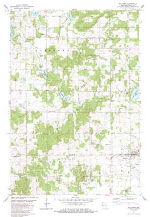
Milltown Topo Map Wisconsin
To zoom in, hover over the map of Milltown
USGS Topo Quad 45092e5 - 1:24,000 scale
| Topo Map Name: | Milltown |
| USGS Topo Quad ID: | 45092e5 |
| Print Size: | ca. 21 1/4" wide x 27" high |
| Southeast Coordinates: | 45.5° N latitude / 92.5° W longitude |
| Map Center Coordinates: | 45.5625° N latitude / 92.5625° W longitude |
| U.S. State: | WI |
| Filename: | o45092e5.jpg |
| Download Map JPG Image: | Milltown topo map 1:24,000 scale |
| Map Type: | Topographic |
| Topo Series: | 7.5´ |
| Map Scale: | 1:24,000 |
| Source of Map Images: | United States Geological Survey (USGS) |
| Alternate Map Versions: |
Milltown SE WI 1974, updated 1976 Download PDF Buy paper map Milltown WI 1983, updated 1983 Download PDF Buy paper map Milltown WI 2010 Download PDF Buy paper map Milltown WI 2013 Download PDF Buy paper map Milltown WI 2015 Download PDF Buy paper map |
1:24,000 Topo Quads surrounding Milltown
> Back to 45092e1 at 1:100,000 scale
> Back to 45092a1 at 1:250,000 scale
> Back to U.S. Topo Maps home
Milltown topo map: Gazetteer
Milltown: Lakes
Bullhead Lake elevation 308m 1010′Camp Douglas Lake elevation 369m 1210′
Clauson Lake elevation 309m 1013′
Ellofson Lake elevation 299m 980′
Forsythe Lake elevation 305m 1000′
Lees Lake elevation 377m 1236′
Little Butternut Lake elevation 366m 1200′
Little Mirror Lake elevation 302m 990′
Sandhill Lake elevation 317m 1040′
Spring Lake elevation 323m 1059′
Wallin Lake elevation 299m 980′
Milltown: Populated Places
Milltown elevation 381m 1250′West Denmark elevation 382m 1253′
Milltown: Streams
Butternut Creek elevation 297m 974′South Branch Trade River elevation 325m 1066′
Milltown digital topo map on disk
Buy this Milltown topo map showing relief, roads, GPS coordinates and other geographical features, as a high-resolution digital map file on DVD:


