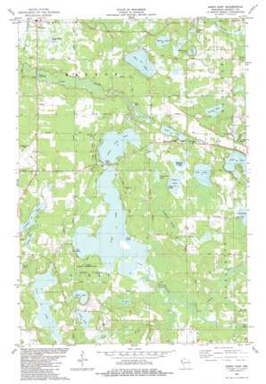
Siren East Topo Map Wisconsin
To zoom in, hover over the map of Siren East
USGS Topo Quad 45092g3 - 1:24,000 scale
| Topo Map Name: | Siren East |
| USGS Topo Quad ID: | 45092g3 |
| Print Size: | ca. 21 1/4" wide x 27" high |
| Southeast Coordinates: | 45.75° N latitude / 92.25° W longitude |
| Map Center Coordinates: | 45.8125° N latitude / 92.3125° W longitude |
| U.S. State: | WI |
| Filename: | o45092g3.jpg |
| Download Map JPG Image: | Siren East topo map 1:24,000 scale |
| Map Type: | Topographic |
| Topo Series: | 7.5´ |
| Map Scale: | 1:24,000 |
| Source of Map Images: | United States Geological Survey (USGS) |
| Alternate Map Versions: |
Siren East WI 1982, updated 1983 Download PDF Buy paper map Siren East WI 2010 Download PDF Buy paper map Siren East WI 2013 Download PDF Buy paper map Siren East WI 2015 Download PDF Buy paper map |
1:24,000 Topo Quads surrounding Siren East
> Back to 45092e1 at 1:100,000 scale
> Back to 45092a1 at 1:250,000 scale
> Back to U.S. Topo Maps home
Siren East topo map: Gazetteer
Siren East: Airports
Burnett County Airport elevation 301m 987′Siren East: Dams
Clam Lake 2WP1065 Dam elevation 292m 958′Siren East: Guts
Sleighbell Slough elevation 301m 987′Siren East: Lakes
Bass Lake elevation 292m 958′Clam Lake elevation 290m 951′
Cranberry Lake elevation 299m 980′
Crooked Lake elevation 299m 980′
Horseshoe Lake elevation 296m 971′
Kapes Lake elevation 297m 974′
Larson Lake elevation 302m 990′
Long Lake elevation 292m 958′
Lower Clam Lake elevation 290m 951′
Mallard Slough elevation 297m 974′
Money Lake elevation 291m 954′
Owl Lake elevation 298m 977′
Pike Lake elevation 295m 967′
Put Lake elevation 294m 964′
Sand Lake elevation 294m 964′
Silver Lake elevation 294m 964′
Sunfish Lake elevation 291m 954′
Tamarack Lake elevation 294m 964′
Taylor Lake elevation 297m 974′
Tucker Lake elevation 297m 974′
Viola Lake elevation 299m 980′
Siren East: Parks
Lyman Bridge Public Access elevation 290m 951′Siren East: Reservoirs
Clam Lake elevation 292m 958′Siren East: Streams
Kent Creek elevation 292m 958′North Fork Clam River elevation 291m 954′
Siren East digital topo map on disk
Buy this Siren East topo map showing relief, roads, GPS coordinates and other geographical features, as a high-resolution digital map file on DVD:


