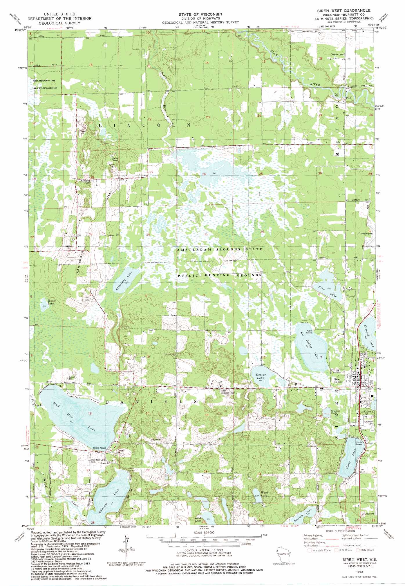
Siren West Topo Map Wisconsin
To zoom in, hover over the map of Siren West
USGS Topo Quad 45092g4 - 1:24,000 scale
| Topo Map Name: | Siren West |
| USGS Topo Quad ID: | 45092g4 |
| Print Size: | ca. 21 1/4" wide x 27" high |
| Southeast Coordinates: | 45.75° N latitude / 92.375° W longitude |
| Map Center Coordinates: | 45.8125° N latitude / 92.4375° W longitude |
| U.S. State: | WI |
| Filename: | o45092g4.jpg |
| Download Map JPG Image: | Siren West topo map 1:24,000 scale |
| Map Type: | Topographic |
| Topo Series: | 7.5´ |
| Map Scale: | 1:24,000 |
| Source of Map Images: | United States Geological Survey (USGS) |
| Alternate Map Versions: |
Siren West WI 1982, updated 1983 Download PDF Buy paper map Siren West WI 2010 Download PDF Buy paper map Siren West WI 2013 Download PDF Buy paper map Siren West WI 2015 Download PDF Buy paper map |
1:24,000 Topo Quads surrounding Siren West
Cloverdale |
Wilbur Lake |
Danbury West |
Danbury East |
Webb Lake |
Lake Clayton |
Saint Johns Landing |
Yellow Lake |
Webster |
Birch Island Lake |
Grantsburg |
Falun |
Siren West |
Siren East |
Hertel |
Trade River |
Trade Lake |
Frederic |
Clam Falls |
Indian Creek |
Cushing |
Milltown |
Luck |
Big Round Lake |
Mckinley |
> Back to 45092e1 at 1:100,000 scale
> Back to 45092a1 at 1:250,000 scale
> Back to U.S. Topo Maps home
Siren West topo map: Gazetteer
Siren West: Dams
Amsterdam Slough G12 90 Dam elevation 294m 964′Siren West: Lakes
Big Doctor Lake elevation 299m 980′Blomberg Lake elevation 296m 971′
Clear Lake elevation 299m 980′
Doctor Lake elevation 299m 980′
Dunham Lake elevation 296m 971′
Fish Lake elevation 296m 971′
Lind Lake elevation 302m 990′
Mud Hen Lake elevation 294m 964′
Swamp Lake elevation 302m 990′
Ward Lake elevation 315m 1033′
Wilson Lake elevation 293m 961′
Siren West: Parks
Amsterdam Sloughs State Public Hunting Grounds elevation 296m 971′Blomberg Lake State Natural Area elevation 297m 974′
Siren West: Populated Places
Siren elevation 304m 997′Siren West: Post Offices
Siren Post Office elevation 304m 997′Siren West: Reservoirs
Amsterdam Slough Flowage elevation 294m 964′Siren West digital topo map on disk
Buy this Siren West topo map showing relief, roads, GPS coordinates and other geographical features, as a high-resolution digital map file on DVD: