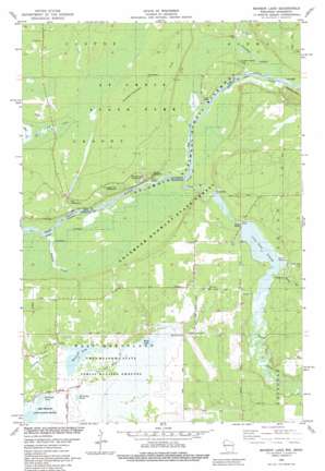
Saint Johns Landing Topo Map Wisconsin
To zoom in, hover over the map of Saint Johns Landing
USGS Topo Quad 45092h5 - 1:24,000 scale
| Topo Map Name: | Saint Johns Landing |
| USGS Topo Quad ID: | 45092h5 |
| Print Size: | ca. 21 1/4" wide x 27" high |
| Southeast Coordinates: | 45.875° N latitude / 92.5° W longitude |
| Map Center Coordinates: | 45.9375° N latitude / 92.5625° W longitude |
| U.S. States: | WI, MN |
| Filename: | o45092h5.jpg |
| Download Map JPG Image: | Saint Johns Landing topo map 1:24,000 scale |
| Map Type: | Topographic |
| Topo Series: | 7.5´ |
| Map Scale: | 1:24,000 |
| Source of Map Images: | United States Geological Survey (USGS) |
| Alternate Map Versions: |
Monson Lake WI 1982, updated 1983 Download PDF Buy paper map Monson Lake WI 2010 Download PDF Buy paper map Monson Lake WI 2013 Download PDF Buy paper map Monson Lake WI 2015 Download PDF Buy paper map |
1:24,000 Topo Quads surrounding Saint Johns Landing
> Back to 45092e1 at 1:100,000 scale
> Back to 45092a1 at 1:250,000 scale
> Back to U.S. Topo Maps home
Saint Johns Landing topo map: Gazetteer
Saint Johns Landing: Bridges
Balcom Bridge elevation 275m 902′Saint Johns Landing: Dams
Clam River 2WP516 Dam elevation 273m 895′Clayton Lake Dam elevation 275m 902′
Saint Johns Landing: Forests
Governor Knowles State Forest elevation 266m 872′Saint Johns Landing: Lakes
Reed Lake elevation 287m 941′Reisinger Lake elevation 286m 938′
Zalensky Pond elevation 289m 948′
Saint Johns Landing: Parks
Kohler-Peet Barrens and Cedar Swamp State Natural Area elevation 275m 902′Reed Lake Meadow State Natural Area elevation 290m 951′
Saint Croix State Park elevation 285m 935′
Saint Johns Landing: Populated Places
Saint Johns Landing Camp elevation 272m 892′Saint Johns Landing: Reservoirs
Clam River Flowage elevation 273m 895′Clam River Flowage 383 elevation 266m 872′
Clayton Lake elevation 275m 902′
Monson Lake elevation 287m 941′
Saint Johns Landing: Streams
Barrett Creek elevation 262m 859′Clam River elevation 262m 859′
Crooked Creek elevation 263m 862′
Dody Brook elevation 274m 898′
Little Hay Creek elevation 268m 879′
Saint Johns Landing: Summits
Pease Hill elevation 296m 971′Saint Johns Landing: Swamps
Currey Flowage elevation 288m 944′Saint Johns Landing: Trails
Minnesota-Wisconsin Boundary State Trail elevation 285m 935′Saint Johns Landing digital topo map on disk
Buy this Saint Johns Landing topo map showing relief, roads, GPS coordinates and other geographical features, as a high-resolution digital map file on DVD:


