Linwood Topo Map Minnesota
To zoom in, hover over the map of Linwood
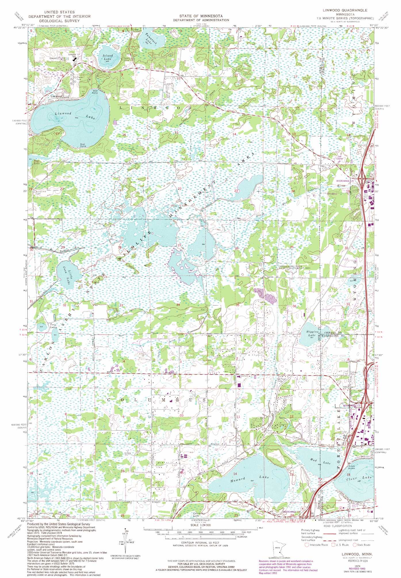
USGS Topo Quad 45093c1 - 1:24,000 scale
| Topo Map Name: | Linwood |
| USGS Topo Quad ID: | 45093c1 |
| Print Size: | ca. 21 1/4" wide x 27" high |
| Southeast Coordinates: | 45.25° N latitude / 93° W longitude |
| Map Center Coordinates: | 45.3125° N latitude / 93.0625° W longitude |
| U.S. State: | MN |
| Filename: | o45093c1.jpg |
| Download Map JPG Image: | Linwood topo map 1:24,000 scale |
| Map Type: | Topographic |
| Topo Series: | 7.5´ |
| Map Scale: | 1:24,000 |
| Source of Map Images: | United States Geological Survey (USGS) |
| Alternate Map Versions: |
Linwood MN 1974, updated 1988 Download PDF Buy paper map Linwood MN 1974, updated 1993 Download PDF Buy paper map Linwood MN 2010 Download PDF Buy paper map Linwood MN 2013 Download PDF Buy paper map Linwood MN 2016 Download PDF Buy paper map |
1:24,000 Topo Quads surrounding Linwood
Bradford |
Cambridge |
Stark |
North Branch |
Sunrise |
Saint Francis |
Isanti |
Typo Lake |
Stacy |
Lindstrom |
Cedar |
Coon Lake Beach |
Linwood |
Forest Lake |
Scandia |
Coon Rapids |
Circle Pines |
Centerville |
Hugo |
Marine On Saint Croix |
Minneapolis North |
New Brighton |
White Bear Lake West |
White Bear Lake East |
Stillwater |
> Back to 45093a1 at 1:100,000 scale
> Back to 45092a1 at 1:250,000 scale
> Back to U.S. Topo Maps home
Linwood topo map: Gazetteer
Linwood: Canals
County Ditch Number Fortyfour elevation 276m 905′County Ditch Number Thirtyfive elevation 277m 908′
County Ditch Number Thirtyone elevation 274m 898′
Linwood: Crossings
Interchange 135 elevation 270m 885′Linwood: Lakes
Clear Lake elevation 269m 882′Higgins Lake elevation 273m 895′
Howard Lake elevation 269m 882′
Island Lake elevation 272m 892′
Linwood Lake elevation 272m 892′
Little Coon Lake elevation 272m 892′
Mud Lake elevation 269m 882′
Tamarack Lake elevation 272m 892′
Twin Lakes elevation 273m 895′
Linwood: Levees
Forest Lake South Bound Rest Area elevation 274m 898′Linwood: Parks
Carlos Avery State Wildlife Management Area elevation 274m 898′Linwood: Populated Places
Columbus elevation 278m 912′Linwood elevation 277m 908′
Linwood: Post Offices
Linwood Post Office (historical) elevation 277m 908′Linwood digital topo map on disk
Buy this Linwood topo map showing relief, roads, GPS coordinates and other geographical features, as a high-resolution digital map file on DVD: