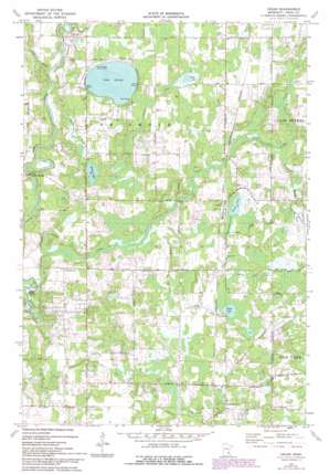
Cedar Topo Map Minnesota
To zoom in, hover over the map of Cedar
USGS Topo Quad 45093c3 - 1:24,000 scale
| Topo Map Name: | Cedar |
| USGS Topo Quad ID: | 45093c3 |
| Print Size: | ca. 21 1/4" wide x 27" high |
| Southeast Coordinates: | 45.25° N latitude / 93.25° W longitude |
| Map Center Coordinates: | 45.3125° N latitude / 93.3125° W longitude |
| U.S. State: | MN |
| Filename: | o45093c3.jpg |
| Download Map JPG Image: | Cedar topo map 1:24,000 scale |
| Map Type: | Topographic |
| Topo Series: | 7.5´ |
| Map Scale: | 1:24,000 |
| Source of Map Images: | United States Geological Survey (USGS) |
| Alternate Map Versions: |
Cedar MN 1974, updated 1976 Download PDF Buy paper map Cedar MN 1974, updated 1993 Download PDF Buy paper map Cedar MN 2010 Download PDF Buy paper map Cedar MN 2013 Download PDF Buy paper map Cedar MN 2016 Download PDF Buy paper map |
1:24,000 Topo Quads surrounding Cedar
> Back to 45093a1 at 1:100,000 scale
> Back to 45092a1 at 1:250,000 scale
> Back to U.S. Topo Maps home
Cedar topo map: Gazetteer
Cedar: Bridges
Gillespie Bridge elevation 263m 862′Cedar: Canals
County Ditch Number Fortyeight elevation 270m 885′County Ditch Number Fortyeight elevation 274m 898′
County Ditch Number Ninteen elevation 268m 879′
County Ditch Number Ninteen elevation 276m 905′
County Ditch Number Seventyone elevation 274m 898′
County Ditch Number Six elevation 269m 882′
County Ditch Number Thirtyseven elevation 274m 898′
County Ditch Number Twentynine elevation 272m 892′
Cedar: Lakes
Grass Lake elevation 276m 905′Hickey Lake elevation 270m 885′
Lake George elevation 273m 895′
Swan Lake elevation 273m 895′
Ward Lake elevation 273m 895′
Cedar: Parks
Lake George County Park elevation 277m 908′Cedar: Populated Places
Cedar elevation 275m 902′Constance elevation 276m 905′
Oak Grove elevation 273m 895′
Cedar: Post Offices
Constance Post Office (historical) elevation 276m 905′Oakgrove Post Office (historical) elevation 273m 895′
Cedar: Streams
Cedar Creek elevation 260m 853′Crooked Brook elevation 269m 882′
Mahoney Brook elevation 264m 866′
Seelye Brook elevation 266m 872′
Cedar digital topo map on disk
Buy this Cedar topo map showing relief, roads, GPS coordinates and other geographical features, as a high-resolution digital map file on DVD:


