Big Lake Topo Map Minnesota
To zoom in, hover over the map of Big Lake
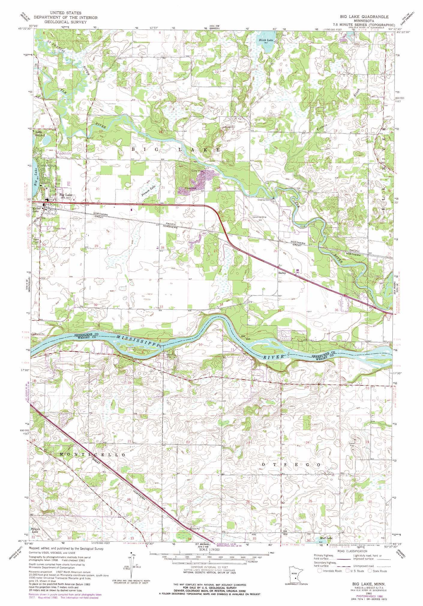
USGS Topo Quad 45093c6 - 1:24,000 scale
| Topo Map Name: | Big Lake |
| USGS Topo Quad ID: | 45093c6 |
| Print Size: | ca. 21 1/4" wide x 27" high |
| Southeast Coordinates: | 45.25° N latitude / 93.625° W longitude |
| Map Center Coordinates: | 45.3125° N latitude / 93.6875° W longitude |
| U.S. State: | MN |
| Filename: | o45093c6.jpg |
| Download Map JPG Image: | Big Lake topo map 1:24,000 scale |
| Map Type: | Topographic |
| Topo Series: | 7.5´ |
| Map Scale: | 1:24,000 |
| Source of Map Images: | United States Geological Survey (USGS) |
| Alternate Map Versions: |
Big Lake MN 1961, updated 1963 Download PDF Buy paper map Big Lake MN 1961, updated 1980 Download PDF Buy paper map Big Lake MN 1991, updated 1995 Download PDF Buy paper map Big Lake MN 2010 Download PDF Buy paper map Big Lake MN 2013 Download PDF Buy paper map Big Lake MN 2016 Download PDF Buy paper map |
1:24,000 Topo Quads surrounding Big Lake
Duelm |
Santiago |
Princeton Sw |
Princeton |
Wyanett |
Clear Lake |
Becker |
Orrock |
Lake Fremont |
Crown |
Silver Creek |
Monticello |
Big Lake |
Elk River |
Nowthen |
Buffalo West |
Buffalo East |
Saint Michael |
Rogers |
Anoka |
Waverly |
Delano |
Rockford |
Hamel |
Osseo |
> Back to 45093a1 at 1:100,000 scale
> Back to 45092a1 at 1:250,000 scale
> Back to U.S. Topo Maps home
Big Lake topo map: Gazetteer
Big Lake: Airports
Hook Spray Airport elevation 284m 931′Big Lake: Lakes
Beaudry Lake elevation 283m 928′Kerber Lake elevation 283m 928′
Big Lake: Parks
Camp Cozy Park elevation 268m 879′Powell Park elevation 284m 931′
Big Lake: Populated Places
Bailey elevation 281m 921′Big Lake elevation 286m 938′
Big Lake Estates elevation 284m 931′
Big Lake: Post Offices
Big Lake Post Office elevation 287m 941′Big Lake: Streams
Saint Francis River elevation 279m 915′Tibbits Brook elevation 274m 898′
Big Lake: Swamps
Preusse Lake elevation 284m 931′Big Lake digital topo map on disk
Buy this Big Lake topo map showing relief, roads, GPS coordinates and other geographical features, as a high-resolution digital map file on DVD: