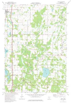
Isanti Topo Map Minnesota
To zoom in, hover over the map of Isanti
USGS Topo Quad 45093d2 - 1:24,000 scale
| Topo Map Name: | Isanti |
| USGS Topo Quad ID: | 45093d2 |
| Print Size: | ca. 21 1/4" wide x 27" high |
| Southeast Coordinates: | 45.375° N latitude / 93.125° W longitude |
| Map Center Coordinates: | 45.4375° N latitude / 93.1875° W longitude |
| U.S. State: | MN |
| Filename: | o45093d2.jpg |
| Download Map JPG Image: | Isanti topo map 1:24,000 scale |
| Map Type: | Topographic |
| Topo Series: | 7.5´ |
| Map Scale: | 1:24,000 |
| Source of Map Images: | United States Geological Survey (USGS) |
| Alternate Map Versions: |
Isanti MN 1974, updated 1976 Download PDF Buy paper map Isanti MN 2010 Download PDF Buy paper map Isanti MN 2013 Download PDF Buy paper map Isanti MN 2016 Download PDF Buy paper map |
1:24,000 Topo Quads surrounding Isanti
> Back to 45093a1 at 1:100,000 scale
> Back to 45092a1 at 1:250,000 scale
> Back to U.S. Topo Maps home
Isanti topo map: Gazetteer
Isanti: Canals
County Ditch Number Thirteen elevation 281m 921′County Ditch Number Twenty elevation 280m 918′
Isanti: Lakes
Beckman Lake elevation 278m 912′Cedar Bog Lake elevation 276m 905′
Coopers Lake elevation 278m 912′
Fish Lake elevation 278m 912′
Ice Lake elevation 277m 908′
Minard Lake elevation 278m 912′
Isanti: Parks
Athens State Wildlife Management Area elevation 283m 928′Cedar Creek Natural History Area elevation 276m 905′
John Anderson Memorial Park elevation 278m 912′
Laurence Collin Township Park elevation 284m 931′
Unity Park elevation 284m 931′
Veterans of Foreign Wars Park elevation 284m 931′
Isanti: Populated Places
Castle Towers Mobile Home Park elevation 283m 928′Coopers Corner elevation 284m 931′
Isanti elevation 285m 935′
Isanti Estates elevation 284m 931′
Isanti: Post Offices
Isanti Post Office elevation 285m 935′Isanti digital topo map on disk
Buy this Isanti topo map showing relief, roads, GPS coordinates and other geographical features, as a high-resolution digital map file on DVD:


