Santiago Topo Map Minnesota
To zoom in, hover over the map of Santiago
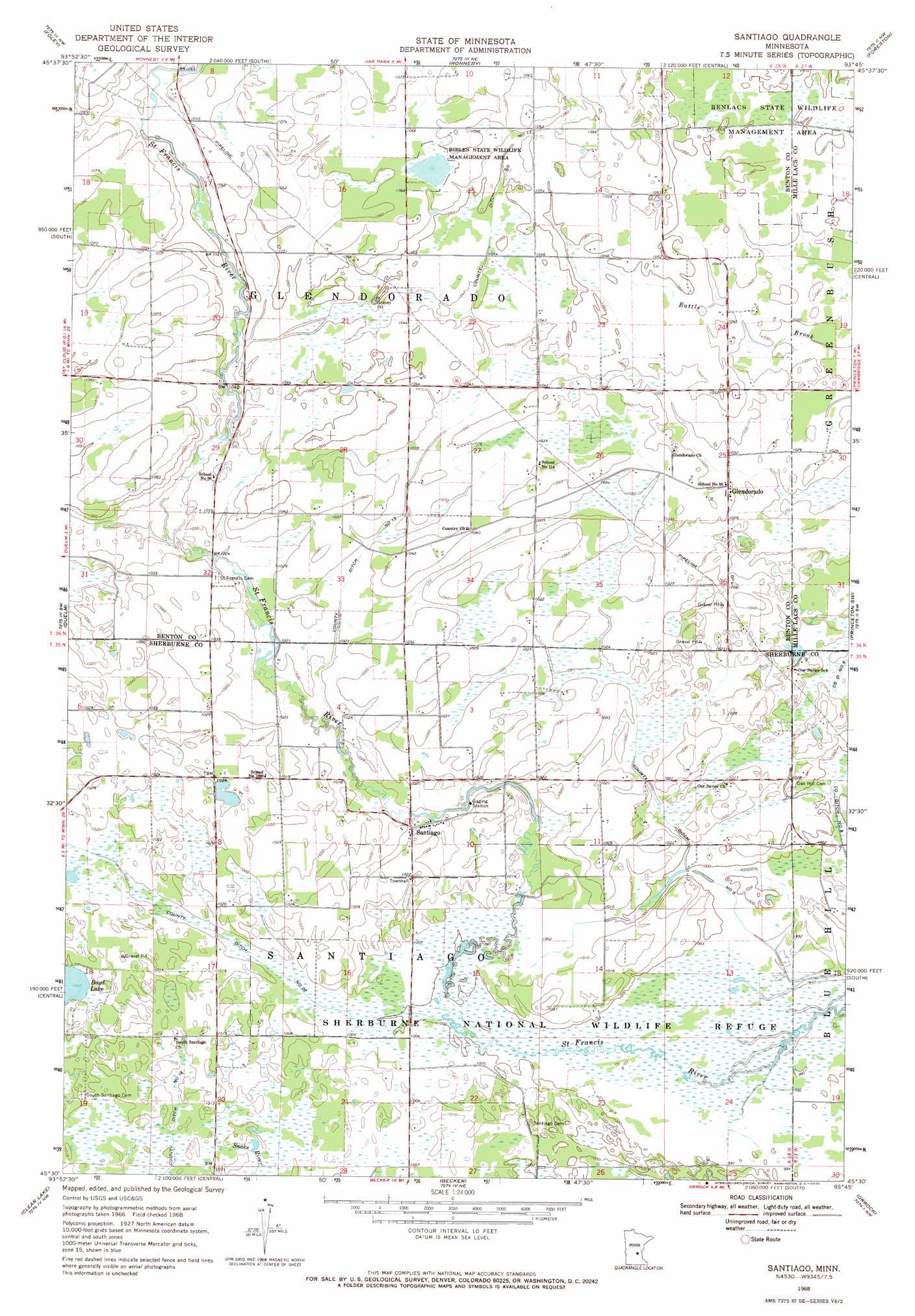
USGS Topo Quad 45093e7 - 1:24,000 scale
| Topo Map Name: | Santiago |
| USGS Topo Quad ID: | 45093e7 |
| Print Size: | ca. 21 1/4" wide x 27" high |
| Southeast Coordinates: | 45.5° N latitude / 93.75° W longitude |
| Map Center Coordinates: | 45.5625° N latitude / 93.8125° W longitude |
| U.S. State: | MN |
| Filename: | o45093e7.jpg |
| Download Map JPG Image: | Santiago topo map 1:24,000 scale |
| Map Type: | Topographic |
| Topo Series: | 7.5´ |
| Map Scale: | 1:24,000 |
| Source of Map Images: | United States Geological Survey (USGS) |
| Alternate Map Versions: |
Santiago MN 1968, updated 1970 Download PDF Buy paper map Santiago MN 2010 Download PDF Buy paper map Santiago MN 2013 Download PDF Buy paper map Santiago MN 2016 Download PDF Buy paper map |
1:24,000 Topo Quads surrounding Santiago
Little Rock |
Ramey |
Rum River |
Milaca |
Bock |
Mayhew |
Foley |
Ronneby |
Foreston |
Princeton Ne |
Cable |
Duelm |
Santiago |
Princeton Sw |
Princeton |
Clearwater |
Clear Lake |
Becker |
Orrock |
Lake Fremont |
Annandale |
Silver Creek |
Monticello |
Big Lake |
Elk River |
> Back to 45093e1 at 1:100,000 scale
> Back to 45092a1 at 1:250,000 scale
> Back to U.S. Topo Maps home
Santiago topo map: Gazetteer
Santiago: Canals
County Ditch Number Five elevation 303m 994′County Ditch Number Ninteen elevation 308m 1010′
County Ditch Number Thirteen elevation 317m 1040′
County Ditch Number Twentytwo elevation 308m 1010′
Santiago: Dams
Fox Pond Dam elevation 308m 1010′Sherburne National Wildlife Refuge Dam elevation 307m 1007′
Santiago: Parks
Benlacs State Wildlife Management Area elevation 320m 1049′Bibles State Wildlife Management Area elevation 324m 1062′
Santiago: Populated Places
Glendorado elevation 314m 1030′Santiago elevation 309m 1013′
Santiago: Post Offices
Glendorado Post Office (historical) elevation 314m 1030′Santiago Post Office elevation 308m 1010′
Santiago: Reservoirs
Fox Pond elevation 308m 1010′Pool Number 1 elevation 307m 1007′
Santiago digital topo map on disk
Buy this Santiago topo map showing relief, roads, GPS coordinates and other geographical features, as a high-resolution digital map file on DVD: