Foreston Topo Map Minnesota
To zoom in, hover over the map of Foreston
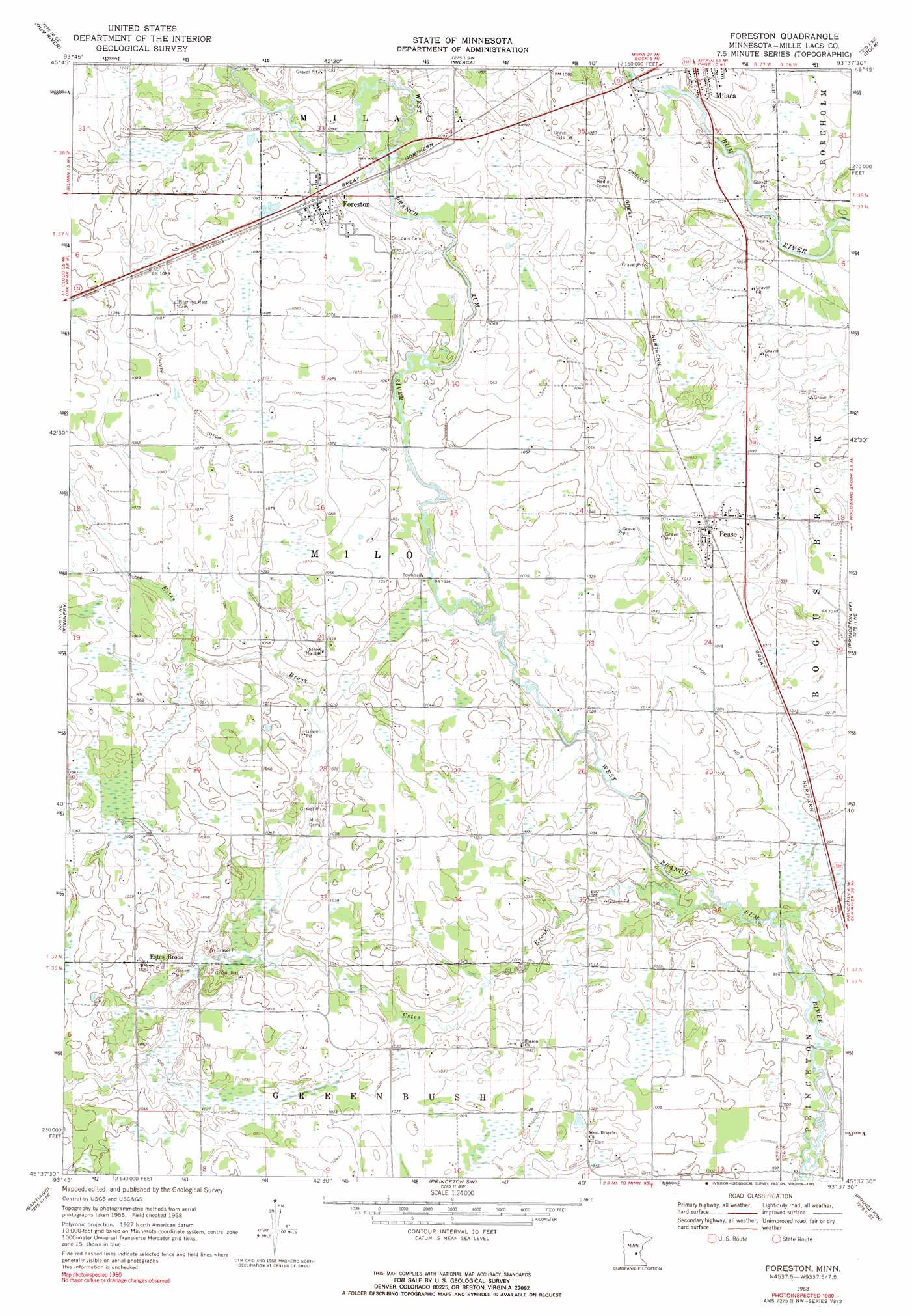
USGS Topo Quad 45093f6 - 1:24,000 scale
| Topo Map Name: | Foreston |
| USGS Topo Quad ID: | 45093f6 |
| Print Size: | ca. 21 1/4" wide x 27" high |
| Southeast Coordinates: | 45.625° N latitude / 93.625° W longitude |
| Map Center Coordinates: | 45.6875° N latitude / 93.6875° W longitude |
| U.S. State: | MN |
| Filename: | o45093f6.jpg |
| Download Map JPG Image: | Foreston topo map 1:24,000 scale |
| Map Type: | Topographic |
| Topo Series: | 7.5´ |
| Map Scale: | 1:24,000 |
| Source of Map Images: | United States Geological Survey (USGS) |
| Alternate Map Versions: |
Foreston MN 1968, updated 1970 Download PDF Buy paper map Foreston MN 1968, updated 1991 Download PDF Buy paper map Foreston MN 2010 Download PDF Buy paper map Foreston MN 2013 Download PDF Buy paper map Foreston MN 2016 Download PDF Buy paper map |
1:24,000 Topo Quads surrounding Foreston
Ramey Nw |
Ramey Ne |
Page |
Milaca Ne |
Ann Lake |
Ramey |
Rum River |
Milaca |
Bock |
Ogilvie |
Foley |
Ronneby |
Foreston |
Princeton Ne |
Dalbo |
Duelm |
Santiago |
Princeton Sw |
Princeton |
Wyanett |
Clear Lake |
Becker |
Orrock |
Lake Fremont |
Crown |
> Back to 45093e1 at 1:100,000 scale
> Back to 45092a1 at 1:250,000 scale
> Back to U.S. Topo Maps home
Foreston topo map: Gazetteer
Foreston: Canals
County Ditch Number Nine elevation 308m 1010′County Ditch Number Three elevation 326m 1069′
Foreston: Populated Places
Estes Brook elevation 320m 1049′Foreston elevation 333m 1092′
Pease elevation 316m 1036′
Foreston: Streams
Estes Brook elevation 302m 990′Foreston digital topo map on disk
Buy this Foreston topo map showing relief, roads, GPS coordinates and other geographical features, as a high-resolution digital map file on DVD: